Sandstone Way variations
Over the last few years I’ve got into the habit of heading of heading off on a fast packing/recce trip the moment the Autumn term ends. Late December isn’t perhaps the best time of year for wild-camping, but it seems to be an effective way of ‘resetting my head’ before Christmas. After a tough few months at work I wanted to do the same again this year, but the question was what/where. There was no upcoming race route that I needed to recce. I toyed with going back to the Pennine Way, but thought something new would be a better adventure. In the end I settled on a variation on the Sandstone Way, a 120 mile mountain biking route that runs South from Berwick-upon-Tweed to Hexham. There is a race along it which I’ve thought about doing, but it’s in October, right after the nightmare which is the start of term. From the outset I decided to cut some corners off the route. Partly because I needed to be back at work on Tuesday, and partly because there were some uninspiring looking road sections which could be by-passed along footpaths.
I’m normally pretty organised about packing kit, but I only got around to throwing stuff into a rucksack the night before. It turned out I had too much kit to fit comfortably into my UD Fastpack, so I ended up taking it (almost...) all out again and using my trusty big OMM pack. To minimise travel costs, while not committing myself to catching a specific train home, I bought a return to Newcastle and an advance single from Newcastle to Berwick. Which led to the slightly farcical situation of getting off one train to Berwick to get on the following train 15 minutes later. At this point I decided to get the map out to look at where I’d be going tomorrow. But I couldn’t find it. Where had I put it? I called the other-half: Me: “I’ve got a strange question for you. There’s a rucksack in the hall. Does it have a map in it?”. OH: “(rummages-around) yes there’s one which says “Sandstone Way” on the front”. Me: “F*!?... Well I do at least have the route on my GPS”. Except I didn’t. I hadn’t synced it properly. I spent the rest of the journey frantically trying to sync my GPS wirelessly and download TopoGPS maps onto my phone. Not the most relaxing start to the weekend... Eventually I got to the Youth Hostel in Berwick, and to my huge relief, discovered that they had Sandstone Way maps to buy.
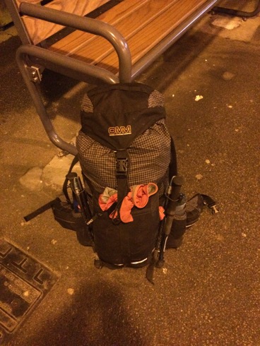
Rucksack (with no map in it...).
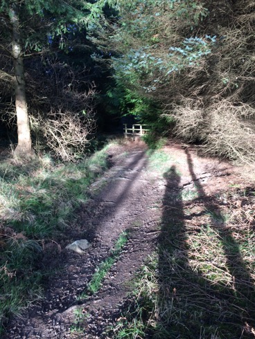
I set off at ~7 the next morning. I was planning on taking it fairly easy (and stopping for proper night’s sleep) but I’d have to put in fairly long days to get to Hexham by mid-afternoon on Monday. It was cold and sometimes icey underfoot. But the Sun came up to a gorgeous day. I’d often gazed out of train windows longingly at this stretch of coast, so it was great to run-walk my way along it. The Sandstone Way occasionally left the coast, but I stuck to the coastal path. This went fine until just after Holy Island, where I missed the turn inland and ended up scrambling along the side of a drainage ditch to get back on the path. After slightly nerve-wracking crossings of the East Coast Mainline and the A1 in quick succession, I followed the St. Cuthbert’s way through some through some picturesque woods and a rather excellent hermit’s cave (I quite fancied moving in...).
The rest of the day was a bit dull, lots of roads and sometimes muddy tracks. To cut milage I wasn’t planning to go into Wooler or Rotherbury, so my route wouldn’t pass through any towns other than Bellingham. I’d earmarked Chatton (which according to the map had a pub) as somewhere to stop and stock up on food, but the village shop had closed at midday and the pub was more of a hotel. Even if I could have brought myself to pay 15 quid for an overly poncey meal, I’m not sure they’d have wanted muddy, sweaty me as a customer... I did find a tap outside a closed cafe later on to top up my water bottles though. The next section, over a moor, was a bit more fun than the roads and tracks through farmland. I pondered stopping and camping there, but decided to press on a bit further, and tuck myself away in some woods for the night.
After another pre-dawn start I had to explain to a bemused dog walker what I was up to. And shortly afterwards a truck pulled up next to me on a lane. I was expecting a “what are you doing scaring my livestock” farmer’s rant, but quickly relaxed when I saw the driver was wearing an inov8 cap. It turned out he was a long-distance running coach, putting out markers for a race. We had a chat about ultra-running and he told me to stop in at a checkpoint up the road for a hot drink.
My deviation around Rothbury took me up onto the moors again. Which was good, apart from a minor nav mistake, which made me appreciate the usefulness of contours (the Sandstone Way map has none). This was followed by miles of dull, stoney forestry tracks, reminiscent of the Pennine Way before Byrness (unsurprisingly since it isn’t many miles away). I’d been looking forward to getting to West Woodbury, and hopefully stopping at the pub there for a meal. But things went a bit pear-shaped. First I decided to cut a corner off the route using a footpath. I picked my way across a rutted field only to be greeted by a 2nd field full of angry cows who didn’t want to let me pass. My next short-cut took me to a set of stepping stones, which were submerged under water, leading to a 2nd retreat.
Eventually I got to the pub. It had a sign saying “Good food served all day” outside, so I took my muddy boots off and went inside. It looked like a bit of a “localy” pub, so I was doubtful about the “good food” but any food would be fine. The woman behind the bar finished serving someone, walked off, and didn’t come back. I wandered into the restaurant bit next door and found a teenage waitress laying up tables. She was very friendly but told me that the kitchen wouldn’t in fact be opening for another hour (an interesting definition of “all day”). I needed to get to the Co-op in Bellingham before it stopped to buy food for the next day, so I decided to press on. As I put my muddy boots back on, some beered-up locals spilled out and offered me a lift to Bellingham... Which was kind but a little alarming.
In Bellingham I stocked up on pies, doughnuts and crisps, before heading to the nicest looking pub for a meal. The food was really good, but spicy stir-fried noodles aren’t the ideal running food and I couldn’t finish them. The pub meal made me soft, and I wondered if there was a bunk-house or hostel I could stay at for the night. According to the YHA web-site there a hostel and it had beds available for the night. I nearly booked online, but decided it would be easier just to turn up. So I did. And was greeted by a not particularly friendly woman who acted like I’d knocked on the door of a random house and told me they were in fact closed, and I couldn’t stay because they’d “been painting”. So I stomped off onto the moors and found a sheltered place to stop.
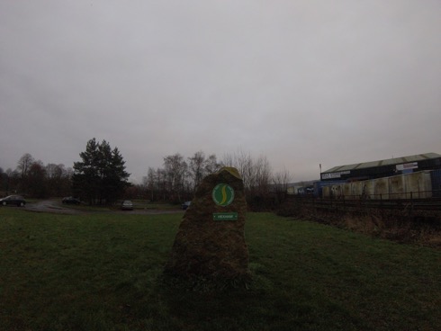
The first few miles the next morning overlapped, on and off, with the Pennine Way, which brought back (mostly fond...) memories. One of the local farmers had identified their sheep with metallic blue and purple paint, which made me smile. Less amusing was a closed bridge, which required a mile detour around it. To cut another small corner I decided to take a footpath across a farm. There were various signs saying the footpath had been diverted, but it wasn’t clear where to, so I marched across the field. At the other side 2 women asked me whether I’d got past the bulls OK... Apparently the footpath hadn’t been diverted at all and the farmer was trying to discourage walkers. The final few miles into Hexham were really dull, so I ran it to get it over with as soon as possible. The end of the route, on a patch of grass outside an industrial estate, was a little underwhelming:
It was a fun weekend, but large stretches of the route are a bit dull and I’m less keen on doing the race than I was before.
Escape from Meriden
So what route would I take, if I was going to do it? The LDWA web-page has an excellent searchable data-base of footpaths, but again footpaths tend not to be very straight. Google maps found me a fairly direct route on minor roads North from Meriden to Derby, and home (Chesterfield) is another ~20 mile North again... I was getting hooked. The problem would be getting home at the end of the 24 hours. I asked the OH if he’d be willing to pick me up from an unspecified location, somewhere North of Chesterfield at midnight. He agreed, and also offered to meet me somewhere along the way with resupplies of food and clothes. So the moment entries opened (literally...) I entered.
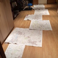
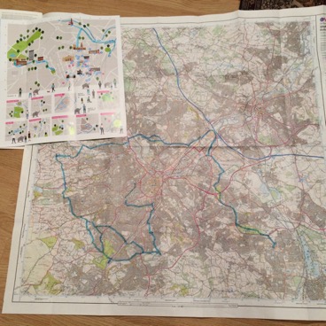
I bought cheap OS maps covering my route from Dash4it. Downloading and printing maps would have been cheaper. But I wanted to see my route laid out, and see if I could spot footpaths cutting corners which google maps had missed. It turns out the google maps route finding algorithm is pretty efficient, even for foot travel, and I couldn’t find any improvements. It wasn’t clear what the best route between Derby and Chesterfield was, there were several parallel options with similar distance. I’d planned to drive out and check them out one weekend but didn’t find/make the time to do it. I deliberately routed myself through Chesterfield, so I could stop at home and refuel. And after that I was going to take the trans-Pennine trail North towards Rotherham. I’m sure google maps would have found me a more optimal road route, but by that stage I thought I’d be glad to get off roads and onto familiar trails (my standard Sunday flat long route goes North on the trans-Pennine trail, with laps of Rother Valley Country Park, for mental toughness, in the middle). I wasn’t sure how far North I’d be able to get, but google maps found me some more minor roads (with pavements) running North from Rotherham towards Barnsley. I was unlikely to get beyond Barnsley, but (in a bout of last minute panic kit buying) bought a map which covered up to Wakefield and the Gold medal 90 mile ‘crow-flies’ distance, so that if I got that far I could ‘wing it’, rather than having to stop due to a lack of map. I marked the route on the OS maps and then (in what felt like an act of vandalism) cut them up and laminated them. I downloaded my route to the Suunto Ambit 3 that I’d bought in the aftermath of my navigation ‘issues’ at Trans Scania. I also bought a hand-held torch, with a red rear light, for added visibility when running along roads.
Race day came along and I realised I’d underestimated how challenging starting a race at midnight, at the end of a looong working week would be. I tried to have a nap in my office after my 4pm lecture, but in the end gave up and surfed the web until it was time to get the train to Birmingham. At Birmingham New Street station a pissed bloke (who turned out to be a decent runner) wanted to know what me and the handful of other people in lycra were off to do. I got to Birmingham International station just as a Jess Glynne gig was finishing, and had to fight my way through throngs of women charging in the opposite direction. The final stage of the journey was a bus-ride to Meriden, where various familiar faces assembled in the village hall.
At midnight we diverged in various directions. There seemed to be ~10 people heading on a similar route North, most in front of me (and, for reasons I didn’t understand, running with their backs to the oncoming traffic) and a handful behind. The first few hours went smoothly, a head torch behind kept closing on me, but never quite caught me. There were a surprising number of cars on the minor, pavement-less, roads. Some were driving fairly fast, so staying alert, and frequently jumping into verge was crucial. In the early hours it got really cold. I had plenty of clothes on (and more spare layers in my beloved Ultimate Direction PB 3.0 pack), but staying upright on the slippery roads and pavements was slow and tedious and I was feeling pretty tired and miserable. In Ashby-de-la Zouch I caught up with Mat and Joanne, who I discovered also live in Chesterfield. I stopped to eat some food and texted the OH, asking him to bring a sleeping bag to our rendez-vous North of Derby, so I could have a nap on the back seat of the car. (I didn’t realise he had his phone by the bed, just in case something went wrong and I needed him to pick me up, so I accidentally woke him up at 6am. Oops.) I was feeling sufficiently crap though that I was seriously contemplating just heading straight home with him.
As it got light the traffic got heavier, and also much worse at spotting me, so there was much more verge jumping. The worst bit was Swarkestone bridge over the River Trent. The road was really narrow, and even with my back pressed into the bridge wall cars were nearly clipping me, and the bridge was covered in debris from crashes. I was very glad to get across in one piece. Eventually I made it into Derby. It was a really Sunny morning, and I was rattling through my water supplies, but there were still icy patches in the shade. Because the OH was going to be resupplying me, I got sloppy with my kit. I finished all my water and got soaked in sweat, because I couldn’t be bothered to take my jacket off. And then I started to panic, what if he hadn’t made it to our meeting point, Little Eaton? We hadn’t fixed an exact spot, so when I reached Little Eaton I phoned him. It turned out he’d just that minute arrived and we were ~100m apart.
I changed into dry clothes and crawled into the sleeping bag on the back seat, having issued instructions to wake me up in 15 minutes. Despite being perfectly warm, I was shivering violently and didn’t sleep at all, but I did feel better for the rest. I then tried to eat some food. It took 10 minutes to get a small cheese and onion pasty down, with lots of retching (the OH kindly gave me a plastic bag, just in case...). After a longer than planned stop I headed North again, with the goal of running home at very least, and maybe keeping going to 60 ‘crow files’ miles and a Silver medal. The roads had wide cycle paths or pavements, it was a gorgeous day and I soon started feeling perkier. I’d even go as far as saying I was having fun... Until I encountered another hairy section, just North of Ripley, which made me wish I’d checked my route out in the car. I was on a B-road, which looked completely innocuous on a map. But in reality it was narrow, undulating and bendy, with lots of fast moving traffic and no verge to jump onto. I was very glad to reach Higham and the A61, which as well as being familiar running territory, is nice and straight with good pavements. I was now feeling good again, and dropped any thoughts of stopping at home.
To my surprise, and happiness, the OH was waiting outside having been watching my progress on the tracking site. To reduce the temptation of stopping I’d set up a mini-checkpoint, a table with gear on and a chair, in our hall. But in the end I decided it would be more comfy to sit in my usual place (on a pile of cushions on the floor in the sitting room) to eat my noodles. Which tasted so good I extended my stop to have a second lot. I changed into warmer gear for the 2nd night (including my knee length ‘spine pants’). I also switched from road shoes to my favourite Race Ultra 290s, which made me realise quite how knackered the cushioning in the road shoes was (they went in the bin the next day).
All told I was stopped for nearly an hour, but I felt a lot better for having got a lot of calories down and was now firmly set on keeping going until midnight. About half a mile from home I realised I was missing my water bottle. I’d given it to the OH to refill along with my bladder, but in the faff of reclosing the bladder the water bottle had got left in the kitchen (and I hadn’t spotted it when doing my ‘am I leaving any kit behind’ check). I couldn’t face going back again, so rang the OH and he drove it out to me.
The one down-side of running along one of my regular routes was that I was going to be moving far slower than usual. But I’d steeled myself for this and it wasn’t too tough mentally. In fact time was moving a lot faster than during the first night and I quite enjoyed reaching Rother Valley County Park and running part of the Round Rotherham 50 route in reverse. On reaching Rotherham I decided to leave the Trans Pennine Trail earlier than planned: running along a derelict tow path in an urban area late at night didn’t seem like a great idea. Through the city centre I improvised my route to avoid the rowdiest clubs/bars, slowed to a walk & turned my head torch off to avoid drawing attention to myself.
North of Rotherham the road undulated, so I walked a fair bit, but it always had a decent pavement. I was now in the last hour and in a win-win situation. If I looked at my watch and it was later than I thought, that meant I was closer to stopping, but if it was earlier I had more time to cover more distance. I didn’t spot the OH drive past in his car, but at 23.45 a familiar figure emerged from a side-road. I wasn’t ready to stop quite yet though, and had already ear-marked a pub a mile or so down the road as my goal. So I crossed the road, told him the plan, crossed back and plodded off again.
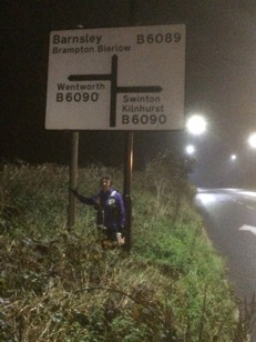
I got to the pub a couple of minutes before midnight, but was now happy to stop. I clambered through some undergrowth and posed for photos under a road sign, before jumping into the car for the, much faster, journey home. I made it 72.7 miles as the crow flies (and covered 82.9 actual miles). It was a couple of miles less than I’d hoped, but given how I struggled through the first night I was satisfied. And surprised to discover that it was enough to place me 10th overall out of 71 individuals/pairs and first woman (just, 2nd place was only a couple of miles ‘behind’ having taken a much hillier route).
Kit review: Ultimate Direction PB 3.0
I was in danger of spending a large fraction of my Northern Traverse blog eulogising about my Ultimate Direction PB 3.0 vest. So I thought it deserved a blog of its own...
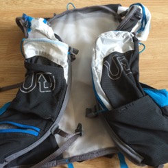
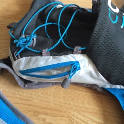
When the 3rd generation Ultimate Direction Signature Series came out I was initially disappointed in the reincarnation of the PB vest. It’s been my go-to pack for long ultras with fairly regular checkpoints/water sources for the past few years. In particular I like that my favourite Camelbak 625ml podium bottles fit comfortably in the front pockets. My 1st generation vest is beginning to show signs of wear, unsurprisingly given the number of miles it’s got on the ‘on the clock’ (500+ miles in races in 2015 alone). So I was debating whether I should get a 2nd generation vest cheap, or wait and get one of the new ones later on. While the main difference between the 1st and 2nd generation packs was a change in colour (red to blue), the 3rd generation vest is significantly different. It’s got a bigger capacity (16l v. 12l), but the big change I didn’t like on first sight is to the front bottle holders. One has been replaced by a zipped ‘burrito’ pocket and the other is now designed to accommodate a soft flask rather than a hard bottle. So I snapped up a cheap 2nd generation blue vest, ready to replace ‘old faithful’ when it finally gives up the ghost.
I started thinking about the PB 3.0 vest again though when trying to work out what pack to use for the Northern Traverse. With ~40 miles between checkpoints I wanted something with more than 12l capacity (although some other runners did happily use 12l race vests). The most suitable pack in my (embarrassingly large) collection was the OMM Adventure Light 20l, which I used for T184 and (pre the invention of race-vests) UTMB. However it only survived T184 thanks to superglue and duck tape, so I did’t want to risk using it for the Northern Traverse. The question was whether to replace it with another one or get something else. One of the things I like about race vests is the multiple, accessible pockets. I went into the Outside shop in Hathersage to take a closer look at the PB 3.0. And ended up buying one.
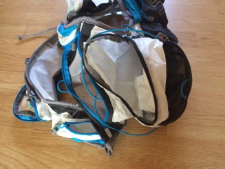
My biggest concern was whether a hard water bottle would fit in the front pocket (I’ve tried soft bottles and I’m really not a fan; they’re a faff to get in and out of the pockets and an even bigger pain to refill). My favourite Camelbak bottles fit, but only just. I wouldn’t want to try getting them back in when tired, and I suspect using them repeatedly would damage the pocket. I ended up using a very tall and thin OMM 500ml bottle on the Northern Traverse, which shredded my lips. I’ve since found a Nathan ‘Fire and Ice’ bottle which fits well, and is OK to use. It is possible to squeeze a small bottle in the zipped ‘burrito’ pocket, but this probably isn’t the best use of that pocket.
Talking about pockets, the PB 3.0 has lots. And I like having lots of pockets to put different things in. As with the previous editions both shoulder straps have a zipped pocket at the top. I use these for storing gels in (up to 5 each). Next comes the bottle holder and the zipped ‘burrito’ pocket, which is useful for big items which might be needed ‘on the run’ (e.g. handheld GPS, mobile phone, head torch, sunglasses, but probably not all of them at once!). Underneath the bottle holder is a zipped pocket (which takes 4 or 5 Mars bars) and underneath the zipped pocket an open stretch mesh pocket (which takes 2 packets of hula hoops). And then around on the side of the pack are another two zipped pockets (which I use for a windproof, cold pizza and more hula hoops...).
At the bottom on the pack there’s a big open mesh pocket with a compression bungy above (which I use for waterproof trousers and jacket). And behind the bungy there’s another open pocket (perfect for cheese and onion pasties and even more hula hoops!).
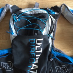
Behind the main zipped part of the bag is a separate zipped compartment, which fits a 2 litre bladder. A full bladder significantly reduces the capacity of the main compartment. But there’s still enough room for the standard compulsory kit (fleece, hat and gloves, survival bag).
Finally (in terms of pockets) at the top on one side there’s a small zipped pocket (which I used for valuables, e.g. cash, cards and keys in a zip lock bag).
Since the Northern Traverse alternates big climbs with long flat stretches I wanted to be able to stash my poles. There are loops on the side for doing this. It took a bit of trial and error to work out how best to arrange my poles (which are admittedly slightly chunkier than typical minimalist ultra running poles). Carrying them like this is a bit irritating, my arms would occasionally catch them, but they were a lot more secure and stable than I would have guessed. I could get them out and pack them away again without taking the pack off, however by day two I couldn’t be bothered and instead carried the poles in my hand when I didn’t need them.
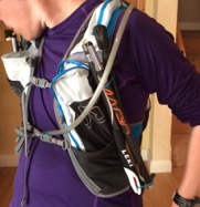
I find the pack extremely comfortable. Over 3.5 days I only got back/shoulder ache once, on the side which my tracker was attached to (there’s room to attach a standard sized tracker on the shoulder strap, behind the zipped pockets). I removed some of the gels from the (probably over-full) shoulder pocket and this solved the problem. Like the earlier versions the edges of the vest are lined with soft, fleecy material, and thanks to this (and also lashings of sudocrem) I didn’t suffer any chaffing at all.
The sizing of the new vests is slightly different to previous versions, and is done by circumference at the bottom of the ribs. Small is supposed to fit 24-33 inches (and medium 31-40). I’m 30 inches and small fits me perfectly. However the straps in the side pockets couldn’t be cinched in much more, so I’m not sure it would fit someone substantially smaller (i.e. a lot of female runners) well. I’m fairly broad shouldered and flat chested (damn those farming genes...). I don’t know whether or not this pack would fit someone with a larger ribs to chest differential (i.e. bigger boobs!).
The PB 3.0 won’t replace the earlier versions as my ‘go to’ pack for long races with food/water sources every ~20 miles. I prefer to carry water in two hard bottles up front (rather than one and a bladder), and the larger capacity is overkill. However it is now my first choice for races with longer gaps between supplies (I used it for Trans Scania) and big days out (like my elephant hunt).
Trans Scania tips for foreigners
Trans Scania is a small (~20 participants) 246km (153 mile) trail race across the South of Sweden (from the West coast to the East Coast and then most of the way back). It’s really well organised, but the only support during the race is a single drop-bag accessed at ~43 and ~116 miles. You can have a support crew if you want, but in 2016 most of the runners appeared not to. I’ve blogged about my experience of doing the race (and getting lost lots...) elsewhere. Here are some, hopefully useful, tips for non-Swedes doing the race in future:
1) Navigation
The maps are 1:50k scale and parts of the route wind through dense forests with multiple paths. The route is marked, but the markers aren’t directional and often aren’t in the most useful places (and on a couple of occasions appeared to do confusing things).
Unless you’ve got yoda-like navigation skills, having the route on a gps device will make your life a lot easier (and your run a lot faster). I’m usually an OK navigator. On a race like this I’d usually make a handful of mistakes, the vast majority of which would only cost me a couple of minutes. I don’t have enough digits to count the number of nav errors I made at Trans Scania. And lots of them were time-consuming (and distance adding). I’m guessing I possibly wasted 2 or 3 hours.
2) Food supplies
Check out the race Facebook page for locations and opening hours of supermarkets, cafes and water taps. They’re frequent enough that you don’t need to carry huge amounts of supplies, but rare enough that you need to plan. The most common supermarket (both in Sweden and on the race route) is ICA. It’s worth having a look around one in advance to see what they stock (there’s an ICA just outside the train station in Lund). There’s less ‘portable vegetarian running junk food’ than in the UK, IMHO. No cheese and onion pasties (one of my favourite multi-day running foods), but I wish British supermarkets sold drinking yogurt (lot of easy to consume calories).
3) Equipment: footwear & head torch
I’d suggest moderately (but not super) grippy, cushioned trail shoes. There’s a significant amount of road/hard track, but also some short, sharp ascents/descents on small stones/grit, and a lot of rutted/rooty paths. There are some field crossings. I can’t imagine they’d ever get as muddy as British field paths do. But if it rains lots in the run up, it’d be worth getting some local advice about underfoot conditions. I used Inov8 Race Ultra 290s and was happy with them (for reference I usually run UK canal tow path races in road shoes).
A head torch with variable brightness is useful, so you can up it a bit on technical sections and a lot when looking for trail markers. I used a Petzl Myo RXP, and again was happy with it (I don’t think something with a brighter max would have made looking for route markers in the dark any easier).
4) Wildlife
There’s lots. I saw (and hurdled...) my first ‘wild’ snake (it was a very small one though). The cattle don’t seem particularly aggressive. I wouldn’t suggest trying to run through them. But, in my experience, even the herds with a bull in, can easily be walked around or, if necessary, shooed off the path. On the other-hand wild boar (who aren’t used to humans coming through their home at night) should be given a wide berth...
5) Electric fences
There are lots of them, they’re live and give you a hefty kick if you touch them for too long. However if you think you need to climb one, something has gone wrong. Some of them have rubber handles and hooks which allow you to lift the top wire and step over the bottom one. Others have hidden squeeze routes around the sides.
6) Pacing
I probably shouldn’t make sweeping generalisations about nationalities on the basis of my personal experience of two Swedish ultras. But I will. Swedes are, on the whole, much, much better at pacing than Brits. In a 100+ mile race in Britain I’d expect to be off the back of the pack for the first ~20 miles, and then slowly work my way up to mid-field (on a good day at least...). At Trans Scania, despite running even more slowly than usual, there were a handful of people not far ahead of me for the first few hours. And even if I’d been fit, I wouldn’t have been able to run/walk at as close to even pace as most of the rest of the field.
7) Logistics
The easiest place to fly into is Copenhagen. There are regular trains to Lund, taking ~45 minutes (a bit more in the incoming direction due to passport checks, a bit less in the opposite direction). Hotel Lundia, is right next to the finish, close to the train station, reasonably priced and very Scandinavian. In Copenhagen, CabinInn Metro is very basic, but cheap and conveniently located (close to the train line for Lund and 2 stops from the airport).
Check-in and security at Copenhagen airport are (as with most Nordic things) remarkably efficient, and there are some decent shops in departures. Including a Lego shop with an excellent selection of Star Wars lego...

Trans Scania
I discovered Trans Scania in 2015, when I was looking for a late Summer long run to ward off the post Thames Ring blues. In the end I decided to enter the Liverpool Leeds Canal Race instead. But I added Trans Scania to my running ‘to do’ list. When entries for 2016 opened in October they started filling up quickly. So, in an uncharacteristic act of spontaneity, I entered. It would be my 3rd long race of 2016 (after the Viking Way and the Northern Traverse), but they were well spread out, so I thought it would work OK.
Not long after that things started going wrong. A fall when fell running, which led to a dislocated (and permanently damaged) finger, kicked off six months when nothing went right. I crammed too much training into too short a period of time for the Viking Way. My knees objected and, after 90 of the most uncomfortable miles I’ve ever run, I DNFed the Viking Way. I didn’t do much running between the VW and the Northern Traverse in early June, in the hope that my knees would recover. However the NT was sufficiently hilly (and boggy) that I managed a decent finish by walking most of it (and not sleeping much). And my knees felt better on day 4 than they did at the start. Trans Scania would be a different beast though. I’m not a fast enough walker to walk it in the 60 hour time limit, so I’d need to do more running. I only booked my flight and hotels (and mentally committed to it) in early July after the OH convinced me that if I wasn’t up to running, I could have a short holiday in Sweden.
Through July and August I managed a few long runs (including a 38 mile elephant hunt...), but nothing I’d describe as proper training. My knees weren’t painful, but they were stiff and sore, which made running slow and not much fun. I felt strangely laid back about Trans Scania though. I guess there was no point worrying. While the time-limit wasn’t walkable it was generous enough that if I could keep moving I should be able to finish. And looking at the 2015 results, a ~50 hour finish would hopefully be doable.
Normally my race blogs start with me complaining about being busy/stressed at work, and looking forward to the race as a holiday. But this time was the complete opposite. It was mid-Summer and I’d cleared (or deferred...) the pointless admin crap and was focussing on research, and enjoying myself. I almost wished I could spend the weekend carrying on with my calculations rather than running.
Preparation
Since there would sometimes be a long gap between water sources I decided to use the Ultimate Direction PB 3.0 pack I bought for the Northern Traverse, with a 2 litre bladder (which I’d mostly only partly fill) and a 0.6l bottle. For food I took ~100 calories per hour of my usual running foods (gels, Hula hoops, Mars Bars, Ritz crackers and cold Dominos pizza) and planned to top this up at supermarkets en route.
I bought the recommended maps and highlighted the route (and the deviations at Lövestad and Brösarp) on them. I usually prefer to navigate using a map rather than a GPS (I’ve used a hand-held GPS occasionally on the Spine and the Northern Traverse, but that’s all). I realised that navigating woods using a 1:50, 000 map might be tricky though. So I uploaded the route to my (aging 1st generation) Suunto Ambit and practised using the navigation feature on some of my regular training routes. Also, as a back-up, I downloaded the Topo GPS app recommended by the organisers and bought a couple of power banks for recharging my phone.
The ‘race’
I flew into Copenhagen the morning before the race, so I could get to Lund in time for the pre-race dinner. The dinner was in a somewhat fancy Thai restaurant next to the finish, and also the hotel I was staying in. Not what I’d usually eat the night before a long run, but very tasty. Dinner was early, so I had time to catch up on some work emails before taping my knees, sorting my gear and sleeping.
Taxis took us to the race start at Långa Bryggan, which was indeed a very long bridge. After a low key start, almost everyone walked back along the bridge. I’d already decided that I would walk, to avoid starting the race by tripping and falling in the sea, but I was surprised to have so much company. And even along the roads back to Lund the field didn’t spread out too much. I was at the back most of the way, but there was usually someone in sight in front. At one point I initially missed the route turning off a road onto a footpath (because the thick red line which marked the route made it hard to see what was going on beneath). It didn’t take me long to spot my mistake and correct it, but it was the first sign of what was to come. I wasn’t the only person making mistakes though, there were a couple of runners who overtook me several times, despite me never passing them.
One of the race organisers, Magnus, accompanied us to the start of the Skåneleden trail (which the race would follow) at Skryllegården. We chatted for a bit, and the conversation turned to Physics and we discovered we had a mutual old friend/aquaintance in the form of Max Tegmark. I got to Skryllegården at ~15 miles in about 3.5 hours. A fair bit slower than I’d usually cover that distance, but there were a handful of other runners eating, refilling water bottles and in one case taping chafing. I refilled my water bottle and bladder and set off again fairly quickly. There were several parallel paths and it wasn’t clear which was the right one. I initially took the wrong one, but with the help of the GPS route on my watch soon got myself onto the right path. My suspicion that the map wasn’t high enough resolution to navigate through woods was confirmed, and eventually I got to grips with navigating through the woods using the route on my watch and the yellow markers on trees. I suspected that the watch battery wouldn’t last for the whole race, but hopefully it would get me through to the turn around point at least.
The route was proving a bit harder for me to run than I was expecting, there were a few very short but steep ascents and descents and some over-grown field edge paths. I got to Blentarp, the first place with a shop, at 38 miles at 17.30. A bit later than I’d hoped/expected, but not too much. I stopped at the shop and bought some drinking yogurt, a doughnut and some bread which I ate outside. Over the next few miles, towards the drop bags just outside Sövde, I kept seeing Lena walking at a fast pace in front of me carrying a bag. Whenever the ground under-foot was smooth and runnable, I started to close the gap, but when it got more uneven she pulled away again. I finally caught her at the drop bags, where she told me that her son had messaged her to say that the local radio had reported on the fact that she was outside the shop in Blentarp resting while I bough sweets inside!
I spent about 30 minutes at the drop bags, eating, restocking food and adding some warm layers to my pack for the night. Lena and I left at the same time, but she soon pulled ahead. It began to get dark surprisingly quickly and the drizzle that had been falling for a little while turned to rain. And then, without warning, my watch turned itself off! I knew the battery was going to run out at some point but I hadn’t expected it to happen so soon (in the past, without using the navigation feature it’s lasted 60 hours). And for a brief second I felt terrified. How was I going to navigate my way though the forest, in the dark and rain, on my own with only a useless map? (At this point Lena was still just visible in the distance, but I knew I’d struggle to keep pace with her, and blindly following someone else would’ve been wrong even if it had been possible.) I quickly calmed myself down. I had the route on my phone. Using it all the time would quickly run the battery down. But I had a recharger for the phone (plus another in my drop bag) so I could use it when I really needed it. And in the meantime I resolved to carefully watch out for the route markers, and back track if I didn’t see one for a while.
Initially this went OK, although at one point I wasted a lot of time going back and forth when I was in fact on the right track all along (and metres away from the next route marker). Running along a gravel farm track I spotted a small snake, seconds before I was about to tread on it. I managed to jump over it instead. I’m scared of snakes, and had never seen one in the wild before, but it didn’t bother me as much as I would have guessed it would. I made a few small mistakes when I failed to spot kinks in the route which weren’t visible underneath the thick red route line (although in one cases, judging by the footsteps in the grass, I wasn’t the only person who’d had to wander around at random to find the route).
I’d marked the route and the deviations into Lövestad and Brösarp with a highlighter pen. The map was waterproof, but the highlighter wasn’t. Once I noticed I put the map back in it’s plastic cover, but not before the rain had erased the route deviation into Lövestad. I remembered that it involved a road, so when the Skåneleden turned off the road to Lövestad I initially carried on running down the road, making the most of the flat, even surface. And then I remembered that the instructions also involved a windmill, and I couldn’t see any windmills. So I stopped, got my phone out and downloaded the race instructions. Our deviation was a bit further along the route, and I was cutting a corner, so I back-tracked back onto the trail. I passed a runner sat on a bench outside a farm. He didn’t seem very happy, and I didn’t see him again, so I guess he dropped.
I eventually made it to Lövestad. I’d heard a lot beforehand about how the locals supported the race. The supermarket closed at 8pm, but apparently the owners would sit in the bar opposite, looking out for runners coming through and open the shop for them. By the time I got there after midnight even the bar was closed. So I sat on a piece of sheltered concrete and ate some of my cold pizza.
I wasted a lot of time wandering around a single field just after Lövestad. The map and my phone both agreed that I needed to turn left, but I couldn’t find any more route markers or a way out of the field. Eventually I found the route next to a fence which started in the middle of the field. And then it hit an electric fence beyond which there was a ~2 metre wide gap between two fences which seemed to be completely overgrown. I tried to the right, nothing. I then tried to the left, and found a faint path. But I could see route markers in the overgrown grass between the two fences, so that was the route. I was only a metre off route, but separated from it by a crotch high electric fence. After some gymnastics, and one shock, I managed to get over the fence and back on track.
A bit later I struggled to stay on route as it meandered through some fields with sparse trees. The route markers were few and far between and not all of the wiggles were big enough to show up on the map. Eventually, I decided that walking with my phone in my hand, was faster than repeatedly going off route and having to get it out to get back on course. It made me nervous though, If I dropped the phone and broke it, not only would it be expensive to replace/repair, but I’d be left with no way of navigating through the woods.
Eventually I made it on to some easier to navigate, and run, tracks. Jogging along I heard some high pitched screeching, and saw some small, barrel shaped animals darting around in the bushes on both sides. Luckily Magnus had warned me about the wild boars (and in particular the females being protective of their young), so I hung back until they disappeared. Just before Christinehof I met the two leaders coming back. They were moving fast, but still stopped for a quick chat. They seemed surprised that I was navigating using a paper map and warned me that the next section was tricky. And it was. The route wound through an over-grown forest, through nettles and over downed trees. I only went off course once though and spotted it and got back on track quickly.
Some meandering tracks followed, and I found it hard to keep on top of where I was. Richard (who’d actually been behind me for some of the opening miles) came past in 3rd place. The route briefly went along a road and I overshot a barely visible turn back into fields. Missing the turn was understandable, but I ran significantly further along the road than I should have done before I realised and turned around. Having not refilled my water bottle at either Lövestad (everything was closed...) or Christinehof (the precise location of the tap wasn’t marked and I didn’t spot any signs) I was running low on water and rationing it. In the end I decided to take a risk and refill it from a stream (something I usually avoid doing in low level farm land). As dawn came a string of runners passed in the other direction.
With the Sun up the navigation became a lot easier and I made my way through Brösarp and towards the turn-around at Haväng without any more mishaps. A bunch more runners passed me in the final couple of miles, an hour or so ahead of me. In the UK I’d have been thinking about reeling them in the second half. But the Swedes are better at pacing than the Brits, plus my lack of fitness/training was starting to catch up with me. However I hoped that having seen the route (albeit in the opposite direction) I would loose less time to navigation issues and not slow down too much. Ha ha!
The last runner I saw was Peter, who emerged from the Youth Hostel as I headed down to the beach. I didn’t linger at the turn-around point and headed back to the Youth Hostel to sort myself out. The first thing I did was take my socks off, and had a nasty surprise. The pads of my toes had been hurting, but I’d put that down to gripping too hard on steep slopes, and I wasn’t expecting to have any foot problems. However what I found was the 2nd worse case of maceration I’ve ever had. The worst case ended up with blisters all over the soles and sides of both feet and left me barely able to walk for weeks. So I needed to take some urgent action if I wanted to finish the race. I dried my feet off, and left them uncovered while I ate, rearranged my food supplies, changed the batteries in my head torch, recharged my phone and texted the OH (I hadn’t heard from him since Thursday night and mild irritation was beginning to turn into worry). This took about 20 minutes, after which I recoated my feet with sudocrem, put on a clean, dry pair of socks and got moving, slowly, again.
I stopped at the supermarket in Brösarp for more yogurt and bread, plus some nectarines (they don’t have a high calorie density, but are a nice treat). When I arrived Peter was outside eating. By the time I came out he’d gone, so I was surprised when he reappeared and suggested that we walk together. I guess he’d had trouble finding his way back on to the Skåneleden. When we reached the long straight road after Brösarp, I explained where the turn would be and said I’d like to run for a bit. I expected he was going to drop back but instead he started running too, but far faster than me. He stopped at the turn and we both discarded layers before run/walking together for a while. I was struggling to run anything which wasn’t pancake flat and perfectly even, and every time I stopped to walk Peter would too. We passed Zingo going in the other direction. He’d stopped to sleep, and was worried that he wouldn’t be able to finish within the time limit. I’d been needing a poo for a while so I stopped at a really rather nice outdoor toilet I’d spotted on the outwards journey. When I came out Peter was sat down and said that he felt very tired and was going to stop and rest. I told him that a 10 minute power nap would make him feel much better. I was happy to be back on my own though. I’m an antisocial runner, particularly when I’m not feeling great.
The next stretch was, unsurprisingly, easier to navigate in the daylight and I made it back to the wiggly woods without any problems. But here things went very wrong. I was managing to follow the route markers fine. After a while our yellow markers were joined by blue markers, which I assumed just meant that another, blue, route was overlapping ours at this point. The way (it certainly wasn’t a path) was more over-grown and scrambly than I remembered, but I was following the markers, so it had to be right. And then it ground to a halt at a fence. I got my phone out and discovered that I was way off route. I was a bit nervous about back-tracking through the dense forest (and worried about getting completely lost). However with a combination of memory, the GPS and the route markers I made my way back to the point where the yellow and blue markers reverted back to yellow only. And initially started going back along the route in the wrong direction... I kept my phone in my hand, and checked it regularly, until I, finally, escaped from the woods.
The meandering section which had caused me problems the night before was fine in the daylight. Along the way I passed Peter (who’d obviously passed me when I was on my random walk around the wiggly forest) sat at a bench with his head down. I didn’t say anything as he was obviously trying to sleep. The easier tracks gave me some time to think, and I solved the problem of the missing OH. Had he been sending me iMessages which weren’t getting through? I got my phone out and typed a quick text message: “are you sending iMessages? If so they won’t arrive (because there’s no wifi in forests).” And got an instant reply. Problem solved...
Another mystery was solved later on, at the overgrown path which had appeared to be fenced off (which led to electric fence gymnastics). In the opposite direction, in the daylight, there was a gap visible on one side of the fence to pass through. I made it back to Lövestad by early afternoon and stopped and bought yet more drinking yogurt, bread and nectarines. I sat on the concrete opposite again and got my feet out for an inspection. They were a lot better than at the turn around point, but there were still several patches of maceration. So I sat and ate while they dried off for 20 minutes.
The roads and tracks after Lövestad were straight-forward to navigate in the daylight, and I even got a bit bored, so I got my iPod out and stuck it on shuffle. This was a bad idea. Shortly after, slightly distracted, I made a really silly navigation error. I thought I knew where I was, and took a right turn without looking at the map. Five minutes later I realised I hadn’t seen any route markers since the junction. So I back-tracked to the junction, checked my map and phone, and discovered that I should have turned left.
Listening to music also triggered an ear-worm which lasted for the rest of the race (curiously it wasn’t on my iPod): “Marlene, Marlene. Your eyes sparkle while your diamonds shine”. Even more frustratingly I couldn’t work out what it was. Googling the lyrics was one of the first things I did after checking in to the hotel at the end of the race. It turned out to be an obscure Transvision Vamp album track, “Falling for a goldmine”.
Annoyingly darkness came just before I hit another fiddly forest section around Snogeholm, with multiple overlapping tracks. This was where my GPS watch had died at dusk the night before. I’d made it through then fine, but in the opposite direction it was a different story. I was carefully following the yellow markers. A turn I was looking out for was taking longer to appear than I thought it should. But maybe I was just moving slowly. I was following the yellow markers, so I had to be ‘on route’ (I hadn’t learnt my lesson from the route markers in the wiggly woods earlier...). Eventually I got my phone out and discovered I’d in fact gone several hundred metres past the turn. I later worked out that on this section, ‘our’ yellow markers were a slightly different shade of yellow, with a dark brown/black background. I decided to play it safe and do the rest of this section with my phone in hand. There was a strange wiggle in the GPS track. I dutifully followed it, off the main track to a wooden shelter. I was feeling a bit sleepy, but I decided to push on to the drop-bags, which weren’t far away (and where I’d have extra clothes to keep me warm). Getting back onto the main track was a bit fiddly, even with my phone in my hand.
I eventually made it back to the drop-bags. I didn’t feel too sleepy and could have kept going. But given the navigation issues I was having (and the fact there were another 6 or 7 hours of darkness ahead of me) I decided a 45 minute sleep would be a good idea (and the idea of sleeping until dawn and then setting off in the day-light even briefly crossed my mind). I changed into dry clothes, put some extra layers on top, set my alarm, stuck my bare feet in my dirty washing bin bag (so they’d stay warm while airing) and lay down with my head on my drop bag. It was a bit cold and uncomfortable, but I got some decent sleep, which made me feel better. In every day life I often struggle to get to sleep, because I can’t stop thinking. But here thoughts were coming into my head at such a rate that I couldn’t do anything but let them stream straight through.
At some point I came across a herd of cattle on a track. There was no way around them so I had to go through. Initially I was quite blasé (“I grew up on a farm, I can cope with cows”). And then I spotted the bull... I walked slowly, gently shooing them out of my way and eventually got through. The bull seemed to actually be a calming influence, at least it looked like it was keeping the flightier cows under control. The next field had another herd, sleeping with calves. After a failed attempt at going through, I went around this lot.
Just before Dörrod golf course there was another short wooded section, which had been fine in the daylight, but was tricky at night. I stopped at a shelter to eat some pizza and top my water up, and discovered some luxurious, heated toilets! Just after the golf course there was another over-grown forest section. Despite looking out carefully for the turn-off I marched past it and up the road. I was really tempted to just keep going, the road wouldn’t just be a lot quicker but also significantly shorter. (I usually prefer trails to roads, but I was beginning to get annoyed with the route. Why fight your way through an overgrown forest when there’s a perfectly good, quiet road which goes where you want to go, faster?). It took a lot of will-power to turn around and back-track. It turned out I’d missed the turn off because there actually wasn’t a gap in the fence. Instead there were small route markers at ground level and a section of the electric fence could be lifted up. I kept drifting off the route in the woods, and this ended up being another ‘phone in hand’ section.
Dawn came and I was feeling a bit sleepy, so I sat down for a 5 minute power nap in what appeared to be a very deluxe bus shelter. The next section went through some forest, where shelters had occasionally been built out of branches. And I started ‘seeing’ shelters self-assembling in trees, which was a bit disconcerting. So I sat down for another 10 minute power nap which woke me (and the small furry creature whose home I sat on) up. I got slightly frustrated when it seemed like the route was taking me around 3 of the 4 sides of a square field. Looking at the map afterwards, it didn’t really, although going straight across the field would have been more direct.
The next few miles dragged. The terrain underfoot was too uneven for me to try and run when tired, and I was even struggling to manage to eat and walk at the same time, so I stopped and sat on a rock to get some calories down. There was then a stretch of tracks and road which were faster going. But I got really frustrated when the route cut away from the road to take in some over-grown, rutted field edge paths. Eventually signposts for Skryllegården started appearing, but the distance didn’t always decrease monotonically.
Most of the route is very rural and, outside of the towns, I hadn’t seen many people. But as Lund came closer there were lots of people out walking and running. Fortunately I wasn’t overtaken by any walkers (that has happened in the past...) but it was a bit depressing how easily the runners were gliding past me. A woman, who obviously knew about the race, offered me tea or coffee, and I felt bad declining (explaining that I couldn’t have any because I was running unsupported). Despite living in Stockholm for two years I can’t speak Swedish, however I can understand basic Swedish. So I had several short conversations where the other person would ask questions about what I was doing in Swedish and I’d respond in English.
The final wooded section seemed far longer than it had on the way out. When I eventually got to Skryllegården I sat down (for a bit longer than was probably necessary...), ate and texted the OH to revise my estimated finishing time. The last 8 or 9 miles back to Lund were fairly runnable. And I did run most of them, but still it took a long time. And even though the end was close I kept having to eat, because if I went more than 30 minutes without eating I started feeling sick. I stopped at the edge of Lund to phone Magnus, one of the organisers, and let him know I was close to finishing. We’d been given a map with the last mile or so in a series of high resolution panels, and I ticked them off one by one. Discovering that the last two panels overlapped significantly and I had less distance left than I thought made me very happy. Weaving around people and trying to run on uneven cobbles made me less happy. I turned the corner, past Henrik (who’d finished more than half a day before) in a bar, and tried to run properly into the finish.
Magnus was there waiting with a handful of earlier finishers. One had finished an hour before, but the others had had a good night’s sleep in the meantime! Luckily (especially for the people who had to sit near me on the train to Copenhagen) there was a room at the finish where I could have a quick shower. When I came out Peter had finished, not long behind me. Given how miserable he was when I’d last seen him (more than 24 hours before...) I was happy to see he’d kept going. I phoned the OH, shared race stories with some other finishers and then headed off to the train station.
Post-mortem
I was much, much slower (4 or 5 hours) than I’d hoped. I’m guessing about half of this was due to my navigation ‘issues’. I usually like to think of myself as a decent navigator; not brilliant, but definitely not awful either. However I think I made more mistakes in one weekend than in the entire rest of my life! Some of the wiggles in the route just weren’t visible on a 1:50k map (and sometimes they were, but I didn’t look carefully enough to see them at the time). Plus it took me a while to get to grips with what was and wasn’t marked on the map and how. It didn’t help that the route was marked with a thick red line, which made it hard to see what was underneath (road, track or path) and key junctions were sometimes covered by symbols. Ultimately I think the map wasn’t the best tool for navigating this route.
My various ‘niggles’ and lack of consistent training this year obviously slowed me down a bit down too. But I still don’t understand quite how/why I was so slow during the 2nd half. I’ve been that slow before, but only when I’ve been physically (my 1st two 100s) or mentally (T184) broken. Here, however, I was still running a large fraction of the runnable terrain but my running was slower than most people’s walking pace... Maybe I could have finished an hour or so faster, if I hadn’t stopped to sleep and air my feet. But it wouldn’t have been worth the risk of wasting even more time getting lost while sleep-deprived or my feet blistering so I couldn’t run at all. Looking on the bright-side, at least I didn’t give up mentally and walk it in like I did two years ago at T184.
I’ve managed to run two long events in Summer, with most of the focussed training before the first, successfully in the past. However this was my 3rd long one of 2016. Maybe it would have worked if life hadn’t thrown me so many curve-balls. But as it was I haven’t done back-to-back long runs (which are the staple of my training for 100+ mile events) since March. If running as well as possible was my priority I’d have pulled out of the Viking Way, the Northern Traverse and Trans Scania when the knee problems started in March. However I’m pretty sure I feel happier for having given them a shot. And a mid-field finish at the Northern Traverse (albeit through sleeping less than most other people) and a finish at Trans Scania isn’t a bad year. Just not as good as the past couple, where I kept surprising myself by doing things I thought I wasn’t capable of (finishing the Spine and being close to the front of the field at the Thames Ring).
It’s time to regroup now though. No more super long races this year (I had been fancying the Sandstone Way in October but, thankfully, work commitments have ruled that out). The priority now is to get the niggles sorted (physio appointment booked for next week) and then start building the training up, slowly and consistently, for next year’s Viking Way.
As far as Trans Scania goes, I’ve got unfinished business. Normally I’m a long event box ticker. Rather than going back to events and trying to go a bit faster, I prefer to try new things. Which I think is sensible; I run best when I don’t focus on finishing time or position, and with long ultras various things (weather, stomach problems, feet problems...) can screw up the best laid plans. However I’m not satisfied with the tick I’ve put in the Trans Scania box. The route really doesn’t suit my run-walk-shuffle, but I really should be able to do it in ~48 hours. So I will be back. Not in 2017 (I’ve just entered the Last Annual Vol State 500), but hopefully in the next couple of years. And I’ve got my eye on a Suunto Ambit 3 Peak with super long battery life...
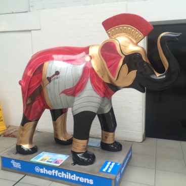
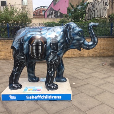
Hunting the Herd of Sheffield
I cooked up the plan to try and see all 58 Herd of Sheffield elephants towards the end of our holiday in Sri Lanka. We were staying at a cool colonial hotel in Bandarawela. Wonderful to look at, but not much to do, and very quickly I got bored. So I decided to catch up on what had been going on in the running world while we’d been busy seeing temples and buddas. And I read about the Accelerate Herd of Sheffield ‘run out’, taking in the 45 elephants in the centre of Sheffield. Which rapidly led to the thought ‘why don’t I try seeing all of them in one day?’, followed by ‘I can do it the Sunday after next when the OH is off to Cambridge for work’. And so I put an OS map of Sheffield in my amazon shopping basket, ready to order the moment we got home.
While waiting for the OS map to arrive I started investigating the locations of the outer elephants, and routes between them using google maps. And had a bit of a shock. The Our Cow Molly farm was (in retrospect unsurprisingly...) right on the edge of Sheffield and while it doesn’t take long to drive from Meadowhall to Crystal Peaks, they’re actually ~8 miles apart. This was going to be a longer day than I’d initially realised.
After marking the outer elephants on the map, the next step was plotting a route linking them. Since I’d be getting the train to Sheffield I decided to clear the city centre elephants first, then head out to the Botanical gardens via Weston Park, nip back to Bramall lane, followed by a big 3/4 circle taking in the outer elephants at Graves Park Animal Farm, Forge Dam, Our Cow Molly Farm, Hillsborough Walled Garden, Meadowhall and finally Crystal Peaks. The advantage of finishing at Crystal Peaks was that I could get the tram back to the station at the end if I wanted. Initially I fancied doing a closed loop by foot. However that was before I’d realised quite how many miles were involved. Plus, while there was a nice-looking off-road route from Meadowhall to Crystal Peaks, from Crystal Peaks to anywhere else (the station or the next elephant around the outer ‘circle’ at Graves Park Animal Farm) would involve lots of grim road miles. I decided to leave the decision about how to get back to the station to the day. I also wasn’t sure whether to just ‘do’ the big elephants or try to see the smaller elephants which were clustered at various indoor locations as well. All but one of the small elephant clusters were in the inner city, so I plotted routes with and without the one outer cluster at Abbeydale industrial hamlet and again decided to make the call on the day.
A couple of spanners were thrown in the works in the days running up to my elephant hunt. First I re-discovered that the 1st train to Sheffield on a Sunday wasn’t until 10am, and then I learnt that some of the big elephants were in locations with restricted Sunday opening hours. The most constraining ones were the Millennium Galleries (11-4) and Graves Park Animal Farm & Hillsborough Walled Garden (both 9-4). I briefly considered doing an out and back to Hillsborough while I was in the city centre, but decided against it, because it would add quite a few miles and the route wouldn’t ‘flow’ as well. Getting to Hillsborough for 4 looked like it should, just, be doable.
I set off on the Sunday with a fairly large rucksack containing 3 litres of water (it looked like it was going to be a hot day), snacks and the usual running bits and pieces. First up I bagged The Warrior at Sheffield station and the 2 elephants outside in Sheaf Square. And rapidly rued the fact I hadn’t put the ‘Herd of Sheffield’ app next to the camera on my phone. Next up was Park Hill followed by the 2 elephants at Victoria Quays. Here I encountered my first and biggest problem in finding and tagging elephants. The 1st elephant was obvious, but then either the locations in the app weren’t right or my phone GPS wasn’t updating fast enough and I couldn’t find the 2nd one. I eventually gave up (convincing myself that it had been damaged and taken away for repairs), but fortunately found it on my way to the next location.
From Lady’s Bridge I headed along the river to Kelham Island. After tagging the outside big elephant I went to investigate seeing the cluster of small elephants indoors at the museum. It was 10.50, the museum didn’t open to 11 and already there was a substantial queue. So, since I didn’t have time to spare if I was going to make Hillsborough for 4, I decided not to do the small elephants. Next was a sweep through the high density of elephants in the city centre. None of them took too long to find, but I’d been at a dark matter conference at the Cutler’s Hall all week and wished I’d spent some time checking their locations out. I also had to keep explaining to considerate parents that I really didn’t mind their children being in the way of my photos.
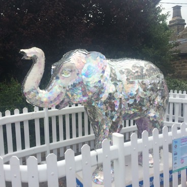
One of the more awkward elephants, was also one of my favourites: Tin Lizzie. Its location on the map wasn’t particularly accurate and, thanks to a permissive path being closed, I had to do an unnecessary loop to get at it. At this point the elephant at Bramall lane was showing on the map app, and it occurred to me that doing an out and back to it now might be more efficient than my planned route. But I decided to stick to my planned route rather than trying to plan a re-route on the fly, and potentially ending up trying to cross rivers and tramlines where there weren’t bridges.
Initially the streets had been fairly quiet, but as midday approached the city came alive, with other elephant hunters, picnickers and people listening to bands in pub gardens (I guess as part of the Tramlines festival). And, it felt good to be part of it (albeit in a slightly obsessive, anti-social way). Passing through the Botanical Gardens I kicked myself for not asking the OH exactly where the memorial tree to his dad is; it would have been nice to have passed by. Here I made my first ‘be lured away from my planned route my spotting the next-but-one-elephant’ mistake, but it didn’t cost me much time or distance.
On the way back towards the city centre to Bramall Lane, my route took me through Sharrow Vale cemetery, which looked fascinating. Definitely somewhere to re-visit in future. Outside there was a big lumpy rock. I thought ‘that’s a bit silly, given how many climbers there are in Sheffield, people are going to climb it’. And then I realised it was in fact designed for bouldering with rubberised matting underneath... Not long after it started raining. A bit shit for the picnicers, but I was glad of its cooling effect.
On the climb up through Meersbrook park I realised I’d been so focused on bagging elephants that I hadn’t had anything to eat, so I slammed down a Mars bar and a packet of hula hoops. The climb up to Graves park seemed to go on forever, and then it took a bit of wandering around inside the Animal Farm before I found the elephant. The farm looked, even to a farmer’s daughter, to have some interesting animals (including some huge pigs) and is another addition to the ‘come back and re-visit’ list.
It was already becoming clear that getting to Hillsborough for 4 was going to be a stretch, so I tried to get a move on down the hill to the A621. Usually if reality isn’t doing what you think the map says it should be doing, then you’re not where you think you are. However in this case, even in retrospect, I’m pretty sure that what the map said the roads & footpaths did and what they actually did were 2 different things. And I wasted 10 minutes, backtracking and ad-libbing to get down into the valley. Which was followed by a climb up another hill before the descent down to Forge dam, where people were ignoring the signs and letting their children climb all over the elephant. I was running a bit low on water, but the toilets only had annoying ‘hole in the wall washers’ (which dispense hot, soapy water) and there was a long queue at the cafe.
Next up was (surprise!) another long climb. I was overtaken by a runner who asked me if I knew where I was going. And when I said yes, he asked me why I was carrying a map then. I resisted the temptation to respond ‘so I know where I’m going’. After Lodge Moor the road plunged steeply into a valley and then my route took footpaths across the fields up the other side. At one point I thought I was going to have to take a detour to avoid a cow and calves. They stood their ground, but let me squeeze past. I could see a farm with a field full of cars, which had to be Our Cow Molly farm. But between me and it was yet another bloody valley...
I’d been promising myself a stop for ice-cream (and water), but the queue was huge. It was already 3.30, so I definitely wasn’t going to make Hillsborough for 4, but still I wanted to keep pushing on. Eventually, on the edge of Hillsborough, I found a supermarket where I bought a litre of water and a six pack of cheese and onion rolls-food of the (ultra-running, vegetarian) gods. In the absence of a bench, I sat on a grubby pavement and ate a couple of the rolls. I arrived at the walled garden at 4.45 to find that it had in fact closed at 4.30 rather than 4.00. Damn! If I hadn’t stopped for food, and had just pushed a bit harder and/or not messed my navigation up after Graves park I’d have made it. I walked around the edge of the walled garden, peering through gates, desperately trying to spot the elephant. I was close enough to tag it with the app, but couldn’t see it. Thankfully the walls were too high for me to contemplate climbing them...
From Hillsborough to Meadowhall was a long, not particularly pleasant, haul. The knowledge that I wasn’t going to manage to see all the elephants took the shine off things. And a planned short cut ended up adding a mile on to the route, because I thought I was going even slower than I actually was, mistook the A6102 for a minor road and over-shot a turn. Running past the Northern General brought back painful memories of the week my FIL sent in the ICU there after an (ultimately fatal) heart-attack. And I really wasn’t in the mood for banter from teenagers (‘only 10 miles to go’). They were, coincidentally, about right though.
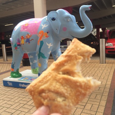
At Meadowhall I bagged the elephants in the wrong order, but thankfully the shopping centre was still open so I could go through it rather than around the outside. I’d rattled through all the water I bought at Hillsborough and desperately needed some more for the final stage. The toilets only had hot water and the vending machines were all either out of order or out of water. Eventually I found a (filthy...) disabled toilet with a cold tap. Drinking this water didn’t seem like a great idea, but I didn’t have much choice. I sat down by the 3rd and final Meadowhall elephant and refuelled for the final stage with the rest of the cheese and onion rolls.
I’d decided to take the Trans-Pennine trail from Meadowhall to Crystal Peaks. A little bit longer than the shortest road route, but hopefully a lot more pleasant. In fact it turned out to be one of my favourite parts of the day. Apart from a short stretch of industrial estates (where I encountered a fox and a rat) the trail mainly went along canals (bringing back memories of various races) and through parklands. The 8+ miles took me more than 2 hours, but it felt like a lot less. I arrived at Crystals Peaks just before dark, got heckled by some small children and took a rare selfie with my final elephant. The day had been longer, and hillier, than I’d expected so there was no question of run-walking back to the station (not least because I might not have made it back for the last train home...)
It turned out to be a bigger challenge than I was expecting (navigating using an OS map in an urban area is tricky and Sheffield is even hillier than I realised). But it was fun, and a good way to ward off the post holiday blues. Not seeing the elephant in Hillsborough Walled Garden is frustrating, and initially I was planning to repeat the entire exercise. With a few route refinements, and knowing exactly where all the elephants are, I think I could do it significantly quicker. However, on 2nd thoughts I don’t think the route is appealing enough to want to repeat it.
Northern Traverse
Before-hand
I entered the Northern Traverse (190 miles, from coast to coast along Wainwright’s classic route) as soon as entries opened in June last year. A single stage race, with no support allowed outside the 4 official checkpoints, is right up my street. I was so keen, I even reced the 2nd half of the route, from Kirkby Stephen to St. Bees over the late May bank holiday before it was officially announced.
My masterplan for 2016 was to get really fit for the Viking Way and then after that switch to specific hill training carrying a moderate pack. In fact nothing went right and my priority after the VW was trying to let my sore knees recover. I didn’t do any hill training and only ran more than 15 miles once. And, due to a poorly pet rabbit, the rece of the 1st half of the route I’d planned for the early May bank holiday got postponed until a fortnight before the event.
Pre-race a bit of kit planning was required (but nowhere near as much as the Spine). The main issue was working out what to put in each drop bag (one would go to checkpoints 1 and 3, the other to 2 and 4). Having accumulated lots of gear over the past few years I didn’t really need to get anything new, but did buy a couple of luxuries/treats: an Ultimate Direction PB 3.0 pack (more about this elsewhere) and some poncey coffee bags (more about them later on...). The organisers provided printed 1:25,000 and 1:50, 000 OS maps with the route marked on by post beforehand. However I decided to stick with the Harvey’s maps, since I was familiar with them and they’re nice and compact.
At the end of last year, before my training went down the drain, I did my usual google stalk of the rest of the women’s field. As far as I could tell there was no clear favourite, and the 6 of us who’d entered looked fairly evenly matched. If I’d been feeling fit I’d have used the same approach as I did at the Thames Ring last year: concentrate on moving as fast as I comfortably could for the first 80% and only start thinking about time and position after that if I was feeling good. Given my lack of training and fitness I was instead planning to treat the NT as a sleep-deprived walking holiday. I knew from my reces that I could walk the whole way and finish within the time-limits. The question was whether I should risk potentially messing my knees up by mixing in some running. In the end I decided to try jogging the flats/downhills on day one, with a vague goal of finishing within 4 days if everything went OK.
There were no trains to St. Bees the day before so the organiser, James Thurlow, and his wife Lisa organised a pick up from Grange-over-Sands train station. Getting there by train on a bank holiday weekend with 2 big drop bags was fun. Looking on the bright side, my drop bags made a good seat. I was in exalted company for the pickup, the other 4 people (who included Eoin Keith) had all finished the Spine Race plus either the Tor des Geants or one of the long Arctic Ultras. Everyone was really friendly and down to Earth, but still I felt out of my league.
After sorting my kit out and having a final dinner (of cold pizza and cheese rolls) I went down to the beach to select a pebble to carry to the East Coast. I liked the look of a crescent moon-shaped pebble, but thought it was too nice to throw in the sea at the other end. So I decided to carry two, this one as a keep-sake and another, less appealing, pebble to throw in the sea. I phoned the OH from a weather battered call box and flapped a lot more than I usually do the night before an event. I fussed about whether I should play it safe and just walk the whole way, and got a bit a gentle scolding when telling the story of my lift-from the station (Me: “And all 4 of the other people were Spine Race finishers. OH: “Why did you phrase it like that? Why not ‘All 5 of us...?’).
Stage 1: St. Bees to Patterdale
Registration etc. in the morning was very well organised. I was happy to see drop bags being weighed to check they were under the 15kg limit. Mine were about that half that, but there’ve been other events where I’ve needlessly skimped on kit to meet a limit which then wasn’t checked. When the race started at 10am it was already quite warm. In 2015 the only time there was hot weather was when I was running long events, it looked like 2016 going to be the same. A couple of people asked me if I wasn’t hot, wearing 3/4 tights and a long sleeved top. This combination had worked well before in similar weather. The long sleeved top was in fact very thin and the sleeves can be rolled up during the day. The 3/4 tights are a bit hotter than ideal during the day, but avoid having to change from shorts to tights at night (when I get cold). However one of the consequences of not having done much training was a couple of extra kilos of lard, which would lead later on to (TMI alert!) more sweating and chafing in the undercarriage department...
Along the cliff tops, I jogged the flats and descents. I thought I was keeping up a decent pace, but after a couple of miles I couldn’t see any one ahead or behind me. I wasn’t surprised to be close to the back (and knew that there were a handful of people behind who were planning to walk the whole way). However I was surprised that the rest of the field had already pulled out of sight.
Over the next few miles I caught up with people, as they got lost or stopped for supplies, but they all dropped me again on the steep descent of Dent hill. I’m never good at descending and with my dodgy knees I was taking it even more slowly than usual. There was a bit of a regrouping at Ennerdale Bridge though. It was pretty hot and I’d already finished the 1.5 litres of water I had in my bladder (I had another 0.5 litres in a bottle) and I bought and downed in one a big bottle of cold water. I’d been fancying an ice-cream or lolly, but the cafe was only selling fancy ice-creams which didn’t appeal.
I didn’t think it was worth wasting energy trying to run along the rocky path besides Ennerdale Water and people pulled away from me again. I passed Hisayo, and the bloke she spent the 1st day with, stopped eating lunch and they offered some to me. Dried mango tasted fantastic, and I’ve added it to my food list for the future (not as a big source of calories, but as something which will go down easily when nothing seems appealing, hopefully paving the way for higher calorie food). On the long climb up to Black Sail hut Jesse (who’d gone back to look for his glasses on Dent hill) caught me and we chatted about the Spine race for a bit before he pulled away. I arrived the YH with Hisayo and the bloke she was with. I stopped to refill my bladder and eat the (proper Ginsters) cheese and onion pasty I’d been carrying as a treat from the start, and moved off before them.
The climb up Loft Beck went fine, but the rocky descent to the Slate Mines isn’t my favourite. Quite how slowly I was moving was emphasised as Ben Taylor floated past me, in sandals. And for emphasis he repeated the manoeuvre on the run-in to Seatoller (having presumably stopped at the cafe at the Slate Mine). I made it up and over Greenup Edge, down Far Easdale gill and past James Kirkby taking photos just before it got dark.
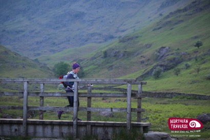
I stopped briefly at Thorney How in Grasmere to top up water and kit-up for the night. However it turned out I didn’t need both a thicker long sleeved top and the windproof I’d put on, and I had to stop on the climb up to Grisedale tarn and swap layers around again before I over-heated. It was a bit windy on top and the tents of the people who’d camped there were getting buffeted. This time (unlike my rece, when I’d passed through at dawn) I didn’t feel jealous. I’d not seen anyone since Ben on the descent into Seatoller, but on the descent a head torch appeared behind and started catching me. This prodded me into a jog along the flat and less uneven tracks and road into Patterdale and CP1.
There was a handful of people (including Angela and Clare) at the CP and Hisayo arrived soon after (having finally ditched the bloke who was slowing her down). There were only a handful of walkers behind us, but a lot of people had stopped to sleep. I never manage to sleep properly on the 1st night of an event, so I’d only planned to sleep here if was feeling really tired. I wasn’t, so my plan was to restock my food supplies, change clothes, relube body and feet, eat and get out within an hour. I had a jacket potato with vegan chilli cooked by Joe Faulkner, plus the first of my coffee bags. In the space of 2 minutes Clare and I both managed to inadvertently insult Joe. First Clare asked him if he was vegan. Then, when someone asked about my coffee bag, I explained that I really like coffee, but can’t drink the instant coffee that you get on events. Joe emerged from the kitchen waving a jug of filter coffee...
Stage 2: Patterdale to Kirkby Stephen
Just as I was ready to depart Angela suggested we leave together. However 5 minutes later she was still sorting her kit out, so I said I’d set off and see her when she caught me (which she undoubtedly would since she’d got in to the CP significantly before me). The next stage started with a long haul up to Kidsty Pike, the last climb in the Lakes and the highest point on the route. It was likely to be cold, but I didn’t want to repeat the over-heating mistake I’d made before and set off wearing just a long-sleeved top and wind-proof. This was definitely the right decision, as initially not over-heating and getting sweaty (rather than my legs or lungs) was the limiting factor in how fast I could climb.
At the end of the first part of the climb, I overshot a right turn. I quickly realised I’d gone off route, got my GPS out to double-check and back-tracked. Up above I could see a head-torch: Angela had already caught and passed me. It was very misty, and staying en route between Angle Tarn and The Knott required concentration. As the route climbed it got cold and windy and I stopped to put on my waterproof jacket. Just after Kidsty Pike the clouds parted, revealing dawn had come and a bloke sped past me. He would be the first of a long stream of much faster runners who’d stopped to sleep at Patterdale.
My knees really didn’t like the steep descent to Haweswater. And the sometimes rocky path beside it and subsequent field crossing were a bit of slog. I’d had no problems eating during day one, but now my stomach was distinctly unhappy and forcing food down was a struggle. Plus the sleepless night was beginning to catch up with me. At the TR I’d discovered that a short power-nap at dawn could fool my body into thinking it had slept. So I set my alarm for 5 minutes and laid down with my head on my pack. It wasn’t a particularly successful sleep, first a group of 3 blokes came past and then Hisayo caught up, but it sorted out the sleepiness.
At Shap I stopped at the Co-op for food supplies, but they didn’t have any cheese and onion pasties and the only thing which appealed was chocolate covered Kendal mint cake. I then took advantage of the public toilets to do a non-al-fresco poo, and texted the OH to tell him about it. He’d just been checking the tracker and replied straight away, which perked me up. I was still struggling to eat though. I have a love-hate relationship with Mule bars, when I love them I love them, but here I repeated the ‘regurgitate it into a bush’ experience I had on the LLC130 race last year. There were lots of nice runnable paths (and lots more blokes came running past me), but I didn’t have the energy to run. Eventually I stopped and sat down in the shade and ate the Kendal mint cake. It didn’t seem to help though. It would take me hours to re-catch the random walkers who’d overtaken me during my short sit down.
Eventually the people who I’d been with on day 1 caught up with me (having stopped to sleep at Patterdale). When 2 of them stopped and sat down for lunch I decided shortly afterwards that I fancied another sit down. As I was struggling to eat I couldn’t use lunch as an excuse, but how about checking my feet? They were feeling a bit sore now I thought about it. So I sat down and took my shoes and socks off, and was very glad that I had. The soles were white and macerated (from sweat). So l forced down some Hula hoops while letting them dry out, before relubing them with Sudocrem.
Shortly afterwards Hisayo caught me, and we ran-walked together for a bit. She’s a much faster runner than me, in particular on uneven terrain but wasn’t confident about her navigation (which was fine as far as I could see, every time I met her she was going in the right direction at least). Eventually everyone I’d been with on day 1 passed me and disappeared into the distance as I plodded along with an empty tank. At LLC130 I’d discovered (thanks to a marshal at a CP) that mints help with nausea. So I’d put a packet in my pack and they were now allowing me to keep a drip feed of calories going. I’d eat a mint, and in the 5 minute nauseous free window that followed try to force down as many Hula hoops or as much of a gel as I could. It didn’t help that it was hot and Sunny again, and I was having to ration the 2.5 litres of water I’d left Shap with (there weren’t many streams on this leg which was mostly across farmland). The final climb before Kirkby Stephen dragged on forever. I really didn’t fancy another 2 or 3 days of this. So I resolved to stop at Kirkby Stephen for as long as was necessary to get down a decent amount of food.
Thankfully the CP had a table full of a wide variety of food, plus pizza and lasagne to order. I had a large plate of veg lasagne plus crisps, bread and yoghurt while engaging in more Spine chat with Andy Cole. It was late afternoon and I wasn’t feeling particularly tired, but definitely wanted to get a couple of hours sleep before heading up onto the moors. The sleeping tents were really well organised: one person tents equipped with a mat and numbered so the CP staff could keep track of who was in each one. I set my alarm for 2.25 hours (three 45 minute sleep cycles), but only slept fitfully due to what I thought was a creaking gate. Why hadn’t I chosen my tent more carefully? I contemplated getting up and shutting the gate but decided doing that would just wake me up for good. I eventually gave up on sleeping a bit before my alarm went off.
When I stuck my head out of the tent I discovered I hadn’t in fact picked a tent by an open gate. The tents were pitched along the side of a rugby pitch and the metal advertising sides were oscillating in the wind. Looking on the bright side I’d have had the same problem whichever tent I’d picked. I went back into the CP, ate even more food, had another of my coffee bags and restocked my rucksack with food. While I was doing this, Hisayo left and was surprised to be told that she was the first women to do so.
Stage 3: Kirkby Stephen to Richmond
I’d stupidly not marked the exact location of the CPs on my Harvey map and I spent a while walking up and down the High Street with my GPS out, trying to work out exactly where I was. I went into two different shops, hoping to stock up on treats, but neither of them had cheese and onion pasties or chocolate covered Kendal mint cake (the 2 things I was craving).
It was a pleasant evening and the climb up to Nine Standards Rig went smoothly, with one stop to put my windproof on. I got there at dusk, but it was easy to follow the route across the bog, which was a lot less wet than when I’d reced it last year. The path to Ravenseat was longer and less smooth than I remember, and the weather got cold and wet. I stopped at Ravenseat to put on full body waterproof cover. I was feeling sick and struggling to eat again. I’d eaten a lot at Kirkby Stephen, but not enough to see me through to Richmond. So I sat on a bench at Keld and forced down some Hula hoops before heading back up on to the moors.
On my rece I’d taken the wrong route from Crackpot Hall and ended up on a narrow trod on the side of a steep hill. This time, in the dark, I had no problem finding the main track. Finding the river crossing at Swinner Gill was another story however. I knew exactly where I was, and where I needed to go, but it took 5 minutes of backing and forthing to work out how to do it. The weather on the moor at the top was pretty miserable, which came as a nasty shock after 2 days of sunshine. I wondered how many people would drop out over night (very few it turned out). I forced a gel down, knowing that I’d need to keep moving to keep warm.
At Gunnerside beck I stopped in some disused mine building to put on my fleece. Ducking into the buildings had taken me slightly off-route, and initially I set off in the wrong direction along the beck. I soon realised what I’d done, but it took a while to convince myself that the right path was definitely right (it initially appeared to go in the wrong direction). I scrambled up Bunton Hush by more or less the same route as I took on my rece, but it wasn’t quite the right route as it brought me up onto Melbecks moor a little bit too soon.
I hadn’t seen anyone since the CP, but on the descent to Surrender Bridge just before dawn 3 head-torches started closing on me. I decided not to even try and keep pace, and sat down at the mine workings and forced down a Mars bar. On the field crossings before Reeth I got my usual post dawn sleepiness. I tried to have a 5 minutes power nap, but it was too cold. Our route took a slight deviation from the Coast to Coast route just before Reeth, and the paths between fields were littered with dead (or in one case dying...) rabbits, which wasn’t particularly pleasant.
At Reeth I was happy to discover that the public toilets were unlocked and I laid down on the floor of the ladies and had a 10 min nap. This perked me up, and for the first time in a long time I managed to do some running. The downside of this, and the rising temperature, was that I kept needing to stop to remove layers. On the field crossings between Marrick and Marske it kept raining on and off. Annoyingly the rain was heavy enough to wet out a windproof, but when it wasn’t raining it was too warm for wearing a waterproof. So I ended up doing more changes of clothes in 2 hours than I’d usually do in a week. At least that’s how it felt.
I ran out of energy again on the run into Richmond and the last few miles seemed to take forever. It was becoming clear that I needed to change my eating strategy. Drip-feeding calories in the form of gels, Mars Bars and Hula Hoops had worked well in the past, but it wasn’t working here. I decided I needed to get hold of some more substantial food, and have bigger food breaks during stages. I also realised that the nausea seemed to peak in the hours following my (precious...) coffee bags. So maybe it wasn’t instant coffee that caused me stomach problems when running, but all coffee. No more coffee bags for me. On my way through Richmond I stopped at a petrol station and bought 4 cheese and onion rolls to see me through the next stage.
Once more I would rue not having marked the exact location of the CP on my map. I knew it was on the far side of Richmond, but it wasn’t where I though it was going to be, slightly off route. And I was getting dangerously close to passing right through Richmond. After wandering around pointlessly for a bit I phoned the OH and asked him to look up where it was on the race web-site. This took a while, and I got a bit (possibly a lot...) princessy, wondering why no-one had spotted me wandering around in circles and come to get me. It turned out the rugby club was just up the road, and if I’d carried on for another 50 metres I’d have seen the signs.
This CP was being run by Jon and Shirley Steele, who run the Hardmoors series of events. And again there was a great selection of food. I knew I needed to get lots of calories onboard again, so set about eating veggie stew, sandwiches and yogurts, before heading to a tent to sleep. I was warned that the weather was really bad at the next and final CP at the Lion Inn and that there might not be anywhere to sleep there. I decided to try and increase my planned sleep from 2.25 to 3 hours. I slept better than at Richmond, but was wide awake again after 2 and a bit hours.
I ate some more food, toast and sandwiches, and was feeling pretty perky. So perky I started spouting random crap at random people (which is very unlike me, I’m usually very quiet around people I don’t know well). While I was eating Angela left, having not slept, while Hisayo had left while I was sleeping. I relubed my feet for the next stage and discovered a small blister, the size of a 5p, in the middle of the ball of one of my feet. I drained it, but didn’t tape it, hoping that it was so small it wouldn’t cause problems.
Stage 4: Richmond to Lion Inn
I wasn’t looking forward to the endless flat field between Richmond and Ingleby Cross and I dug out my iPod and selected a random mix of cheesy chart dance and (not too heavy) metal. On my rece this section had really dragged, but hitting it ‘fresh’ and relatively well fuelled it didn’t seem so bad. I was determined to do a better job of eating during this stage, and stopped just before Catterick to eat the first of my cheese and onion rolls. Just before Danby Wiske two blokes moving at a decent pace caught me, and I managed to keep them in sight for 5 minutes at least.
At Danby Wiske I stopped outside the pub to eat another roll and check out my foot, which was feeling sore. The blister had got significantly bigger, so I drained it again and taped it. Outside one of the many farms there was a cooler full of flapjacks. I dithered as to how many I should buy. As there weren’t many left I decided to just have one, so there’d be some left for the rest of the people coming though that night. Just before the A19, as it was getting dark, I could hear two people catching me (I’m guessing the pair who’d caught me before Danby Wiske had stopped at the pub). I could only hear one side of the conversation, which was a bit irritating, and motivated me to increase the gap, for a little while at least. I stopped at the petrol station next to the A19 and bought another pasty and a flapjack. The woman behind the counter had obviously already encountered people doing the race, and asked me whether it was safe to be going up onto the moors on my own at night. A lot safer than working here I thought, but kept it to myself. I was careful though not to draw attention to myself (there were a lot of lorries parked up for the night) as I left the shop and headed to the toilets to eat and layer up for the night.
Restarting is a common time for navigation errors, and for no good reason I turned left when I should have gone straight on in Ingleby Cross. Having been too awake to sleep in the toilets at the petrol station I was now feeling tired, so decided a 5 minute power nap would be a good idea before heading onto the moors. Again restarting lead to a silly nav error where I turned too soon onto a track parallel to the route. This one was an understandable mistake, but I should have realised that the rutted over-grown track I was fighting my way along wasn’t the Cleveland Way sooner.
Crossing Scarth Wood Moor was fine, but when I dropped back into the woods I was really sleepy again and nearly walked right past a marked turn. Time for another power nap. Just before the climb up to Live Moor I sat down, and forced down a caffeinated gel plus some caffeine tablets for good measure. Initially I was still so sleepy I kept slapping myself and singing along to my iPod to stay awake. ‘Now you’re gone... “, Guns n’ Roses got me across the Cheviots on the Spine, Basehunter would get me across the North York Moors! Eventually the combination of the caffeine and the strong, damp wind woke me up. I descended the steps towards Lord Stones carefully, now would not be the time or place for a fall.
There was a light outside Lord Stones, and I initially wondered if it was someone out waiting for me. I was slightly disappointed when I realised the light was attached to a building, but set about trying to find some shelter to sit down and eat. The women’s toilets were locked, but as a last resort I tried the disabled toilet and was delighted to find it not just open, but heated. I sat on the floor and ate another roll and a flapjack (I tried and failed to eat the pasty from the petrol station; it had the taste and texture of a brick so it ended up in the bin). Somewhat frustratingly I now wasn’t feeling tired, so I set off to do the three hills before Clay Bank.
The weather was really wet and cold (I’m not sure whether it was actually raining, or whether it was ‘just’ the wind blowing the cloud/mist). I’ve been out in far worse weather, but this was the most exposed I’ve ever felt. I wasn’t particularly cold and I still had a spare hat and gloves in my pack, but I was wearing all the rest of my kit and didn’t like not having a spare layer. Trying to playing it safe I looked at the map carefully and located ‘bail out’ routes off of the moors, in case something went wrong and I need them. I also kept constantly monitoring whether I was getting colder and stopped briefly in the relative shelter between each of the hills to force some food down.
On the climb back up after Clay Bank I got really, really sleepy, to the extent it felt like I was sleep walking. The clouds on the top were really dense, and I had the best ‘hallucinations’ I’ve ever had, rows of buildings and even a little old lady in my peripheral vision. Hallucinations is in inverted commas though, because I didn’t, even for a second, think any of the things I was ‘seeing’ were real. I’d love to experience proper hallucinations, and have extended conversations with non-existent gnomes. However I suspect my hyper-rational physicists brain is never going to let that happen...
I told myself I’d force another gel down at Blowarth crossing and that, combined with a strong tail wind, perked me up. Apart from 2 sections where the route turned so it was perpendicular or anti-parallel to the wind (and I struggled to even stand up) I ran all the way to the Lion Inn and arrived there half an hour sooner than I’d estimated when I left Clay Bank. Along the way I pondered what I was going to do when I got to the CP. The final stage was the shortest however there was another ~8 miles of high moorland after the Lion Inn and didn’t think that carrying on in this weather while sleep deprived was a great idea. What was I going to do if they hadn’t managed to get the sleeping tents up? I wondered if it would be possible (or allowed even) to get a room at the Inn for a couple of hours.
To my surprise, and happiness, there was someone waiting outside in the howling wind. They took me through the pub (which felt a bit awkward as the tables were being set for lunch) to a corridor, where people were drying kit and there were toilets/showers. I organised my kit for the next stage. We’d been told that drop bags needed to be waterproof as they’d be kept outside at times. I thought that North Face holdalls would be good enough, but they didn’t keep out the driving rain at the Lion Inn. Anything which wasn’t in a drybag was slightly wet, but thankfully the clothes I wanted to wear were OK. I then stripped off what I thought were going to be wet layers. Outside I’d been convinced that my waterproofs had wetted out and I was soaked through. In fact the outside of my fleece was slightly damp, but otherwise me and my layers were bone-dry. I guess I’d mistaken cold for wet. I then got in the shower and discovered that there was absolutely no water (hot or cold). There was another shower along the corridor but I couldn’t be bothered getting dressed and undressed again (and there was someone outside in the corridor sorting kit, which ruled out sprinting along the corridor naked...). I washed as well as I could in the sink, got dressed and re-taped my foot. I put on thermal tights knowing that they’d probably be too warm once I got down into the valley, but my priority was staying warm while up on the moors.
I’d been told that the CP was ‘being run out the back of a van’ as it had been too windy to get a marquee up. I’d imagined huddling outside in the rain and wind, while food and drinks were served from the back of the van. However in fact the CP was literally being run inside a not too huge transit van: there was a table full of food, a stove for hot food and drinks and half a dozen plastic chairs. The downside was that the condensation rained off the ceiling at random intervals. I had some veg chilli, crisps, yogurts and lots of lots of heavily buttered bread (I stopped after 3rds on the grounds that I shouldn’t eat all the bread). Luckily they had got the sleeping tents up and I had a ~45 minute sleep before faffing with my kit and heading off.
Stage 5: Lion Inn to Robin Hood’s Bay
The first mile or so along the road after the CP was into a headwind, and making any sort of forward progress was a battle (there’s a video showing Eoin Keith having similar problems, which makes me feel less of a wuss). And things got even worse when the route turned off road and into ankle deep water. This was not fun by any definition of the word fun. Eventually I reached the descent to Glaisdale, which I should at least have jogged. But it was too rocky for my increasingly sore feet. I didn’t realise it at the time, but I inadvertently took a long cut into Glaisdale, not having spotted when marking up my map that our route deviated from the Harvey route. I sat on a park bench, removed some layers and ate my remaining cheese and onion roll, and redressed my foot. I was now out of ‘proper’ food, but walked past a small shop, on the grounds that there was bound to be a better shop in Grosmont.
The weather in the valley was quite pleasant and I had to stop again to remove more layers. Forgetting that I was back in civilisation I had a wee by the side of the trail, and narrowly avoided being caught mid-stream by a family out for a walk. I failed to spot a shop in Grosmont, so refuelled with Hula hoops for the big climb out. I’d been dreading this climb. In the past I’ve really struggled with climbs towards the end of events. But it was fine, and I even managed to jog along the flat at the top. Until the blister on my foot burst. It was a bit too chilly to stop there, so I limped down to Littlebeck, where I knew there was a bench. The taping had stopped the blister spreading across the ball of my foot, but instead it was spreading down my foot. I drained and retaped it for the n-th time.
The woods after Littlebeck were really muddy and took forever. It didn’t help that I had to stop several times to do huge wees. I’m not sure what was going on. Possibly I’d drunk too much on the first two days, trying to cool myself down. I made another small navigation error after the Hermitage. Initially my route looked right, but it brought me out on the wrong side of the river at Midge Hall, and required a bit of bank scrambling to put right.
Back up onto the moors and our route deviated from the Harvey’s route that I’d reced. Even with my GPS in hand I was convinced that the path was going in the wrong direction. I was happy that I had reced this stage though, as otherwise the loop up the coast to Hawsker would have been incredibly demoralising. For a while I’d entertained thoughts of finishing in time for last orders, but it had become clear that that wasn’t going to happen.
Just after dark, close to the end of the final moor, I randomly looked back and saw two head-torches. In retrospect, worrying about loosing 2 places seems a bit silly. But at the time (possibly due to memories of getting overtaken by Rich Cranswick close to the end of the Thames Ring) I really didn’t want to get caught so close to the finish. At the TR there was nothing I could have done to keep up with Rich (short of strapping a rocket to my bum). However these head torches were walking rather than running, so maybe I could hold them off. It briefly crossed my mind that the duo could be Angela and Hisayo. But I quickly dismissed that: I hadn’t seen them since Richmond so how would they have got behind me?
I resolved to get some food down, nail finding the rocky track which led off of the moors, stay upright going down the track and then try and run the road into Hawsker. For the first time in days I was hungry and hoovered down all the savoury food in my pack, including a packet of crushed Ritz crackers I’d been carrying from the start. My legs felt as good as they had for weeks and I ran (slightly downhill...) all the way to Hawsker, pausing only at the junctions to double check the route. Passing through what appeared to be an impromptu roadside junkyard a bloke who was randomly rearranging doors told me that I wasn’t going to run all the way to Robin Hood’s Bay, because it was another 5 miles. (I later discovered that he was dispensing pearls of joy, such as ‘it’s really windy on the cliff tops, you’ll get blown off’ to everyone who passed. Comparatively I got off lightly...)
Eddy was waiting in Hawsker and flagged me down to have my photo taken in front of the Robin Hood’s Bay road sign. I ran the rest of the road and turned off towards the caravan park. I knew the route turned right through a caravan park, so when I saw a caravan park I did just that, without checking the map. However I couldn’t find the route off of the caravan park. Eventually I found my way on to a bridleway, and spotted another caravan park between me and the sea. And (with the aid of my GPS) the penny dropped, I’d forgotten there were 2 caravan parks and the route turned right through the 2nd caravan park. I eventually toyed with going ‘off piste’ to the 2nd caravan park, but in the end played it safe (and followed the rules) and back-tracked.
I’d assumed I’d opened up a gap on the head-torches behind by running the road, but how much of it had I just thrown away? I couldn’t see head-torches ahead or behind, so I resolved to move as fast as I comfortably could, while making sure I didn’t screw my navigation up again. The final few miles along the coast dragged, but I kept moving at a decent pace and couldn’t see any head-torches behind me. My phone pinged, with what I guessed was a text message from the OH, but I didn’t want to waste time stoping to read it. In one of the final fields I swerved to avoid a rock, and then had a huge shock when the rock stood up. It was in fact a (thankfully docile) cow.
The final steep decent into Robin Hood’s Bay was painful on my knees, but I managed to run the last bit in to the finish, where RD James Thurlow was waiting. He said something about me being first lady. And my reaction was ‘what? what happened to Angela and the Japanese woman?’ (I was too tired to even try pronouncing Hisayo’s name). It turned out that I’d passed them (Angela ‘on the road’ and Hisayo at the Lion Inn) and they were both not too far behind. The two head-torches I’d seen were actually two blokes who were in the gap between us. The blokes eventually finished just under an hour after me, so my push for the finish was (despite the nav error) fairly effective.
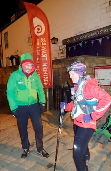
I fumbled around in my pack to find my carefully stashed pebbles, and then took a while to work out which one I wanted to keep, and which one to throw in the sea. James asked my what I wanted to eat and radioed my request of veg pizza to Lisa at the village hall at the top of the hill. There was a competition for the fastest time back up the hill, but there was no way I was going to do anything other than power walk. At the village hall I phoned the OH. He’d been watching the tracker and had stayed up to speak to me (the text he’d sent on the run-in would have revealed I was 1st woman, if I’d read it). I then ate all of a huge pizza, got changed and dozed until Hisayo and Angela finished, as James wanted to get a podium photo of us together. I was getting my usual post race ‘feet being hit with hammers’ sensation, so there was no danger of me sleeping properly until the painkillers kicked in. The downside of the dozing is that while Hisayo and Angela look fresh (and runner like) I look like a random person who’s wandered in off the street and is a bit confused about why they’ve been given a (very fancy) trophy saying ‘first lady’. I’m not photogenic at the best of times, and this was definitely not the best of times.
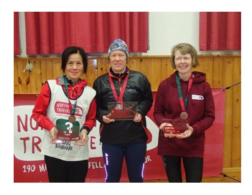
After the photos I managed to get a few decent hours sleep, before eating even more food and walking to the bus stop for the multi-stage journey home (and jokes about being married to the president of the Northern Traverse...).
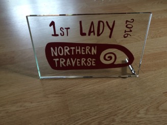
Reflections
I’m satisfied with how it went. I made a few too many silly nav errors. However otherwise I did a pretty good job of playing the (not particularly good) cards I was dealt, both in the run up to and during the event. Being the 1st woman to finish was a nice surprise, but definitely due to luck rather than judgement. I’m surprised, given how little running I did, that I finished in the middle of the field overall. I suspect I moved slower than almost everyone behind me, but spent a larger fraction of the time moving. If everything had gone to plan this year I’m guessing I could maybe have finished 6-8 hours faster, which wouldn’t have moved me much further up the field. I’m better on the flat than in the hills, but my impression is that the front of the field here was a lot stronger than at the flatter events I’ve done `down South’.
Lessons learnt:
- mark CP locations on the map carefully
- watch out for silly nav errors when restarting after a break
- a single rece, a year out is not sufficient to commit the route to memory
- don’t drink any sort of coffee while running, ever.
St Bees to Kirkby Stephen
I couldn’t leave work early enough to get to St. Bees on the Friday night, so instead I stayed in Whitehaven, in a Wetherspoons hotel which was cheap and (to my surprise) quiet and surprisingly poncy. I got the 1st train to St. Bees and set off in gorgeous sunshine. I was carrying a big pack with sleeping gear and, given my dodgy knees, the plan was to walk the whole way. I wasn’t moving much faster than some walkers (and on the rocky descent to Honister mine slower even). But, apart from the occasional twinge, the knees were OK so I was happy.
I stopped at a phonebox in Seathwaite to call home, and check on Fruitbat, before heading up Greenup edge. It was a gorgeous evening to be out in the hills. As darkness came my heading started pounding though (I’m prone to migraines in/after times of stress, and the last few months have been pretty bad). I took some painkillers but they didn’t do anything, so I decided to stop for the night, sooner than planned after Grassmere. I was using a new lightweight bivvy bag for the first time. I’d checked out how the poles worked when I’d bought it. But that was 6 months ago and, with my head feeling like it was in a vice, I couldn’t figure it out now. So I just crawled into the bag in my sleeping bag and zipped it most of the way up. A couple of hours later I woke up soaking wet and gasping for breath. I initially thought it had rained and the bag had (like the one it was replacing...) turned out not to be waterproof. However on sticking my head out I discovered the grass was dry and it was the condensation from my own breath. Evidently the bag wasn’t as breathable as my heavier weight one, and I hadn’t left a big enough ventilation gap. Looking on the bright side (after the sleepless night I spent in a soaking wet down sleeping bag a couple of years ago) I was using a synthetic sleeping bag and was just about warm enough to get back to sleep.
I set off again at dawn, wearing all of the clothes I was carrying. I still wasn’t feeling great (having not eaten properly the night before) and was thinking about the easiest way to bale out and get to a train station (back to Grassmere or onwards to Patterdale or Shap?). I quickly warmed up and as the Sun came up properly started feeling better. On the decent from Grisedale tarn (where I briefly felt jealous of the people still sleeping in tents) I made a silly nav error crossing what I later discovered the guidebook called a ‘tempting bridge’ over the river and following a parallel path.
I stopped at the Post Office in Patterdale (alongside walkers who were setting off for the day) and attempted to stock up on food, but the only thing they had that I fancied was chocolate coated Kendal mint cake. The slog up to Kidsty Pike wasn’t too bad, but the decent was too steep for my liking (even without dodgy knees) and I crawled along Derwentwater (even getting over-taken by a walker) feeling sleepy. It had become clear that I didn’t have a hope of getting to Kirkby Stephen for the last train home. Buses run through Shap, but not it turned out on Sundays.
I stopped at the chip shop in Shap and had a proper sit down meal, which made me feel much better, and (after phoning the other half) decided to press on through the night. The next ~20 miles, through flat-ish fields, went slowly but smoothly. However I did (without realising it at the time) manage an interesting variation on the route at one point. A case of never being more than ~20 metres from where I was supposed to be, but on the wrong side of a wall. On the final climb before Kirkby Stephen I saw, for the first time, what I’m fairly sure were shooting stars.
I eventually arrived at Kirkby Stephen at ~2am, only 8 hours after the last train! One of the waiting rooms was open, and heated, so I settled down for ~4 hours of fairly cosy sleep before the 1st train home. Where I snoozed some more and felt sorry for the commuter who had to sit next to (not particularly fragrant) me.
Viking Way 1, Me 0
Nothing quite went right at the end of 2015/beginning of 2016 and I didn’t even start training properly until February. The sensible thing would have been to pull out. However I decided that having a carrot to get me out the door and running was a good thing, even if it ended in a DNF. Especially since it was looking like my wonky finger might need surgery later in the year. I managed to ramp my mileage up fairly rapidly and got a couple of decent back-to-back weekends in. Four weeks out I reced the first ~85 miles. It went OK, but I had to push hard to make the last train home which left me more knackered than I’d have liked.
The next weekend I ran the 32 mile Haworth Hobble. It was my first ultra back in 2007 and I’ve run it for fun every year since. A 32 mile race, a week after a 85 mile weekend sounds pretty silly in retrospect, but in the past (with a decent training base) I’ve done things like this without any problems. Apart from 2008 (when I strolled around in 8h 20) my Hobble times have come down from 7h 40something to 7h 06. And I’d been hoping that this might finally be the year I broke 7 hours. I felt pretty sluggish from the start. At the first gate a few miles in I was surprised at how short the queue was. I turned around and saw that there were very few people behind me. It was too soon to write a decent time off though, so I kept trying to keep up a decent pace. I went through half way 10 minutes down on last years time, so sub-7 definitely wasn’t happening. But 7.30 would be OK, I thought, given the big weekend I’d just had.
Things went downhill from there though. I was really thirsty and drinking loads, but feeling sick and struggling to eat. At ~22 miles, almost mid-stride, I threw-up, for the first time ever in a sub-100 mile race. From there on in it was just a case of plodding to the finish (since that was probably a quicker way of getting there than DNF-ing). I forced down a biscuit at the next CP and didn’t even bother to try and run most of the long climb up to Top of the Stairs. Finally, a few miles out from the finish, I caught up with Angela (who I’d been back-ing and forthing with all day, as she kept waiting for her husband to catch up). She was walking having just fallen and broken her finger. I decided that sticking with her until her husband caught up was a good idea. Her husband and friend caught us up half a mile from the finish and I jogged it in a few minutes over 8 hours. Nearly, but not quite, a personal worst. Looking on the bright side, I had lots of miles in the bank (albeit a bit slower than I would have liked), my legs were in OK shape (no injuries or major niggles) and I had 3 weeks to rest up. Then, out of the blue, 3 days later my knees started hurting going up and down stairs and when running... And to top everything off the rain kept coming down, so the VW was going to be a complete mud fest.
Come race weekend I wasn’t feeling at all optimistic about my prospects of finishing. My goal was simply to give it my best shot, not give up mentally and see how far I could get. I turned up to race registration the night before in my running gear (I didn’t want to waste space in my drop-bag with clothes that couldn’t, if necessary, be worn for running) and carrying my rucksack, in case there was a kit check. And felt like a right twat when everyone else was there in their jeans...
The next morning was an early start, as Peter F shuttled us across the Humber Road Bridge to the start in the minibus that would later serve as the meat waggon. As we loitered at the start Lindley Chambers, race director Thames Ring 250, tried to tell me that I was capable of finishing, but I really wasn’t convinced. It being a shorter distance than the TR250 should have meant I could run faster (and make the time cut-offs), but for a one-paced-plodder like me it’s not that simple. Before the start there was a group photo, and my usual ‘hide at the back behind taller people’ tactic failed and I ended up slap bang in the middle. Only 1 woman (the legendary Mimi Anderson) has every finished the VW. There had been 5 women on the entry list, but in the end there were only 2 of us on the start line. If I’d been in good shape I’d have felt pressure to be number 2 (or 3), but I was so pessimistic about my chances of finishing that this really wasn’t a factor.
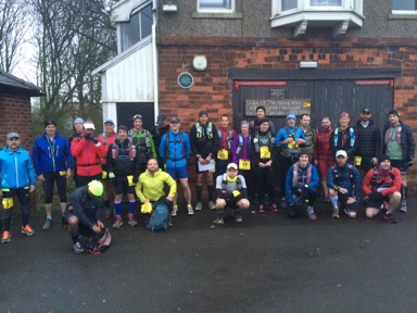
For the first half mile or so the rest of the field didn’t seem to be running too fast. But by 2 miles in I was way off the back of the field. This didn’t bother me though, it was what I’d have expected even if I’d been in good shape. A couple of people came past me having gone off course. One of them was Dave Baker, and he remained visible in front of me until Barnetby le Wold. He missed an (unsignposted) turn and initially I followed him, but stopped when it didn’t look right. Looking at the map I worked out what we’d done, however Dave was out of sight and I couldn’t shout him back. At CP1, just down the route at Bigby, I told Mark what had happened, but Peter F had already been dispatched in the meat wagon to get Dave back on track. Mark confirmed we were indeed right at the back. That, and being ~5 min slower than I’d hoped, didn’t bother me, but the fact that my knees had already started hurting did.
The next stage to Tealby went OK-ish, but various random muscles in my legs had joined my legs in hurting, which was a bit worrying. Mid-stage Lindley was sitting in his truck, presumably monitoring the runners. I waved and kept running, trying to look better than I felt. Eventually I finally started catching people. First up was Javed, who was walking, having not recovered yet from his double Spine. We had a brief chat, but I needed to push on if I was going to make the first cut-off at 50 miles. The day had started a bit chilly and drizzly, but it was now warm and sunny. I briefly considered taking my long sleeved top off and running in my bra, but remembered what happened the last time I did that (Blackpool marathon, 2002...): sun-burn which blistered and permanent skin damage... I stopped at the corner shop in Donington on Bain and bought some water. I’d been dreaming of a Calipo, but (unsurprisingly given the time of year) their ice-cream cabinet was almost empty.
My next catch was Rachel, aka Navigationally Challenged Woman (NCW). At this point she was running, at high speed, along the other side of the road in the wrong direction. I shouted across that the turn was just ahead. I didn’t catch what she said in response, but she kept on running in the wrong direction (OK, if you don’t want to trust my navigation, that’s up to you). She eventually caught me 5 min later, on an uphill, and sprinted past.
I made it to CP3 at 50 miles in ~11.45. 15-45 min slower than I’d hoped, but inside the 12.5 hour cut-off. I ate some cold pizza, restocked my food supplies and put warm kit on for the night. I also changed my shoes. The Scott Supertracs I started in were good on the mud, and had been OK for my rece, but my feet were feeling sore so I swopped grip for comfort and a pair of Inov8 Race Ultra 290s. NCW was meanwhile struggling to sort her kit out for the night, and the marshals were desperately trying to convince her that she’d need to put on, or carry, warm clothes.
The Sun was setting as I ran downhill to Horncastle, and for the first time I actually felt alright. In Horncastle I passed a bloke rummaging in his rucksack. I think this was Stephen Forde, whose splits from a previous year I was using as a benchmark. He was the slowest starter who’d ever gone on to finish, but even so his old splits were 30-60 minutes faster than I was going. I managed to run almost all of the never ending cycle track between Horncastle and Woodall Spa, overtaking (youngest ever Spine Race finisher) Ben Taylor in the process. In Woodall Spa I caught NCW and pointed her in the right direction again. Shortly afterwards she followed a track left rather than taking an obvious (if you were actually looking at your map) footpath. She was too far ahead to shout back, but even if she hadn’t been I’d have been tempted not to. I’d got fed up with the complete lack of thanks for my navigational assistance.
When I reached Lindley, Maxine and Naomi at CP4 at Stixwold I was beginning to think I might have a chance of finishing. I was closing the gap on Stephen Forde’s old splits. My legs were still hurting, but they weren’t getting any worse. We had a bit of banter about how it takes me 60 miles to get warmed up, but I quickly moved on, wanting to keep going while I was feeling good. It started raining again and I passed Ben and Riccardo stopped, putting on waterproofs. The first half of this stage went fine, but then I hit the muddy ploughed fields followed by (long, soaking wet) grass and a bridleway that was ankle deep in mud. In my less grippy shoes I was struggling to stay upright, moving really, really slowly and getting cold. I knew the last few flat miles into Lincoln would be flat and runnable, so I wasn’t sure whether I needed to stop and put on an extra layer and waterproof trousers or not. In the end I decided to play it safe and layered up.
I managed to run most of the river path into Lincoln, but it felt a lot slower than on my rece, even though I was carrying a much smaller load. The cathedral didn’t have it’s lights on, but eventually the lights of Ronnie Statton’s car at CP5 came into view. He was pretty upbeat about how I was doing, but I’d lost time on Stephen Forde’s splits and if felt like the race was beginning to slip away from me again. Ronnie told me that Pete F had gone to pick up Ben and Riccardo and they were hoping to convince NCW to drop too, as she was (literally) all over the place. It seemed like everyone I overtook was DNF-ing, but this was a race where I’d be ecstatic to finish last.
Thanks to the mad dash for the last train on my rece, the route through Lincoln was the one bit I hadn’t reced. We’d been given a separate map for the city, but I think it wasn’t to scale and didn’t have all the roads on. I soon went wrong, but at least knew where I was and where I was going. The rain had eased off and I was over-heating, so I stopped outside the hospital to remove the extra layers. In retrospect I’d have been better off not putting them on. But better safe than sorry and hypothermic. A doctor ran out of the hospital and asked me if I’d seen a patient with a drip. He didn’t seem at all non-plussed about what I was doing in running gear on the streets of Lincoln in the early hours of the morning.
Running, painfully, down Lincoln’s cobbled main street I was shocked to see a clock and discover that an hour had passed since I’d left CP5. I’d only covered a couple of miles though, HTF had that happened? The race wasn’t slipping away from me now, it was accelerating into the distance. I resolved to keep moving as fast as I reasonably could. The fields after Lincoln were really muddy, and without grippy shoes, I was struggling to stay upright let alone run. I caught one more person (Bryan Rudd I think) who told me his wheels had come off. And a few miles later mine followed suit. First I struggled to get over a style; I literally had to lift my legs over with my hands. Then I couldn’t even get my feet off the ground to run. I resigned myself to a long, slow 7 mile shuffle to a DNF at CP7. It was pretty grim. I even managed to loose track of where I was on the map, and how many villages I had left to go through.
I made it to CP7 at 96 miles ~12 min inside the 26.5 hour cut-off, but there was no way I was capable of going any further (at least not at a pace which would get me to the finish anywhere near the cut-off). The one good thing about DNF-ing so close to the cut-off was that I didn’t have to wait long for a lift to Oakham station in the meat wagon. I was in good company; the other meat wagon occupants included 3 time VW finisher (and TR250 joint 1st male) Andy Horsley and Spine Race & Yukon Arctic Ultra finisher Karl Shields. But before we could go to the station we had to find and collect NCW, which wasn’t as simple as just looking at her tracker and going to the next point where the route met a road. She’d gone off course again and we eventually found her running at high speed across a random field... En route to the station the ever positive Ben tried to cheer her up. She responded by telling him that she would have finished if she hadn’t stuck with him and Riccardo through the night. Nice (and about as likely as me running a sub 3 hour marathon...).
The OH kindly came and picked me up from Oakham station. Which was good. I struggled to get in and out of the car, so getting me and my kit on and off trains would have been ‘fun’. My legs were really painful for ~24 hours, but then (apart from my knees...) they recovered pretty quickly.
I didn’t get close to finishing. But I’m satisfied that I gave it the best shot I had this year. I kept on moving forwards as fast as I sensibly could, until it wasn’t physically possible. Given the non-ideal run-up, finishing would have been a minor miracle. But I don’t regret trying. The VW is pretty close to my physical limits, but I don’t know which side of them it lies on. What I’ve learnt from this attempt is that maybe, if everything goes to plan, I might be able to finish it. I will be back...
Viking way rece 2
Ludford, where I’d booked a room for the night, came a few miles sooner than I was expecting. Meaning that I’d left myself more miles than I thought for day 2. I set off early, along what should have been nicely runnable roads. But they were coated in a sheet of ice, so instead I had to inch along the verge. After that it felt like I was making good progress, and when I stopped for lunch (more cheese and onion pasties) in Horncastle I was pretty confident I’d make it to Lincoln by early evening. The disused railway track to Woodall Spa was (apart from the occasional sculptures) dull, but it made for fast going. Woodall Spa was surprisingly posh, there were even proper wooden Viking Way signs! The next stretch involved some more fast going tracks, past a sewage works and a sugar factory to Bardney and the infamous ‘field with no escape’. In the daylight it was fairly easy to spot the exit (a section of electric fence with plastic protectors) but encountering it for the first time in the dark would be a different story.
Lincoln cathedral had been tantalisingly in view for several hours. But first the route went South of it, and now it headed North. I was tempted to take a short cut along roads, but that would defeat the purpose of the recce. The next 5 miles were grim, miles of muddy fields interspersed with fiddly navigation. It was also becoming clear that I’d significantly under-estimated the distance (forgetting to add on the couple of miles over the bridge to the start, and not realising that the Lincoln checkpoint is actually right on the outskirts) and I was at risk of missing the last train home. I ground-out 11 minute miles alongside the waterway (not fast, but not bad for me with a big pack at the end of two days of run-walking). I’d been envisaging a nice gravel cycle track, but instead it was uneven grass, and the cathedral never seemed to get any closer. Eventually I hit the outskirts of Lincoln and headed straight to the station, rather than following the route up to the cathedral. I was desperate to stop for chips but didn’t want to risk getting stranded in Lincoln. I made it to the station with ~5 minutes to spare and instead spent all my loose change on crisps from the vending machine.
2016: the plan
1. Viking Way, April
This is probably the hardest race I’ve ever entered, in terms of probability of me finishing at least. 147 miles across Lincolnshire and Rutland doesn’t sound too hard. But add muddy trails and a 40 hour time cut-off (only 2.5 hours longer than I took to do the pancake flat GUCR) and it’s seriously challenging. I entered it just after finishing the Thames Ring 250. Partly because finishing not far behind 3 time VW finisher Andy Horsley at the TR made me think I might just be able to finish the VW. And partly because my name might not appear too out of place on the entry list any more, now it can have ‘Thames Ring’ and ‘Spine’ after it.
This is going to be hard, really hard. Realistically I’ll only ever be able to finish it if
i) I’m in really good shape,
ii) I have a good day
iii) the weather/conditions under foot aren’t too bad.
Things aren’t looking great at the moment in terms of i) or iii). Three months out I’m starting run training from scratch and, after months of rain, the ground is really, really wet. But I’m not giving up yet. The plan (legs permitting) is to ramp up the training fairly rapidly, with the goal of receing the first 80 miles over 2 days, 4 weeks out. And then all I can do is give it my best shot.
2. Northern Traverse, May/June
Wainwrights Coast to Coast route, 190 miles from St. Bees to Robin Hoods Bay, crossing the Lake District, the Yorkshire Dales and the North York Moors, with a 5 day cut-off. Like the Spine Race, but shorter and in Summer, so less kit to carry. Well ‘up my street’ so I entered as soon as it opened last June (which was good, since it meant I couldn’t then be tempted into trying to take a fortnight off during exam season for the 600 mile Monarch’s Way...).
I reced the 2nd half, from Kirby Stephen to Robin Hood’s bay over the 2015 late Spring bank holiday weekend, and (apart from the tedious field crossings of the Vale of York) had great fun. I’m planning to check out the 1st half at the beginning of May. And, if I manage to get through the Lake District without trashing my legs so badly I can’t run, I’m hoping finishing in around 4 days should be doable.
3. Tran Scania, August
246km unsupported trail race across the South of Sweden with a 60 hour cut-off. I’d toyed with entering this in 2015, but the Leeds Liverpool Canal race fitted in better with the OH’s work travel plans. When entries for 2016 opened in October the small number of places started filling up quickly and without thinking too much (which is very unlike me...) I entered. Combining two of my favourite things, run-walking a long way and spending time in Sweden, should be fun. And the format of this race (unsupported apart from a single drop bag which can be accessed twice) makes it a hybrid of the Thames Ring and T184 and an interesting new challenge.
2015: the good, the bad & the 'still can't believe it'
1. 5th at the Thames Ring 250
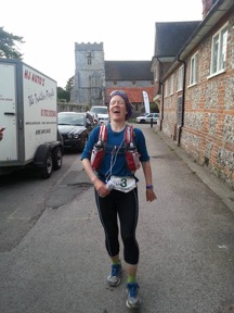
Six months later it still can’t quite believe that I did this. It’s joined my list of ‘things where I worked really hard to do OK and ended up doing far better than I thought I was capable of’ (the other entries are Grade 8 piano, finals and Ironman). I hoped if things went well, and I managed to keep eating and run-walking, I could finish in about 90 hours which should put me in the middle of the field. 82.5 hours and 5th was beyond my wildest dreams.
I struggled through the 2nd night, and wasted time wandering the isles of a 24 hour Tescos randomly and repeatedly sitting down to snooze. But otherwise it went pretty well and I finished feeling like I could have kept going for another couple of days (my swollen left ankle might not have been happy about that though).
2. Not finishing last at the Long Tour of Bradwell
I’d run this twice before, in the midst of training for CCC and UTMB, and finished last both times. So doing it again off the back of six months of running flat canal towpaths might not seem like the greatest idea. But I was hoping that I could turn my ‘plodding on the flat’ into ‘plodding up gentle slopes’. I was still painfully slow on the more technical ups and downs, but the plan worked. I was still close to the back of the pack, but slightly faster than before (on a longer course) and nowhere near last.
3. Purple bling at the Liverpool Leeds canal race
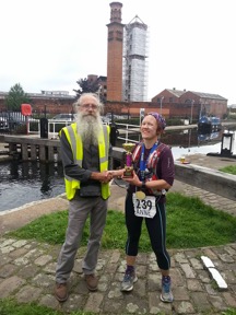
I entered this as something to keep me occupied during the late August bank holiday weekend, didn’t train properly and never felt great. But I kept plodding away, worked my way up from nearly last to mid-field and unexpectedly won a very purple trophy.
The Bad
1. Dropping out of Run Until You Drop with the end in sight
I started this challenge for fun rather than as a serious goal. Fitting it in around work and commuting was a bigger challenge than the actual running, and by week 4 I wasn’t doing much other than working, running, sleeping and eating (and washing running gear). With the end in sight, a random injury stopped me short. It was fun, I discovered some new routes and learnt that it’s possible to fit lots of running into a working day (by pushing the boundaries of acceptable lycra wearing). However I ended up running really slowly, and I really don’t need to practice running slowly. It was probably OK as Thames Ring training, but I won’t be trying it again.
2. The wonky finger incident
My body and brain needed a break from ultra running, so I entered a series of mini mountain marathons in the Autumn. After mixed results in the first 2 events, I was having a great (for me) run in the 3rd one. I’d been more ambitious with my route choice, bagged the three highest value controls and was on my way back to the finish when I tripped, fell and dislocated my finger. Surprisingly it didn’t hurt and somehow I didn’t do any major ligament damage, but 6 weeks later it’s still a bit wonky looking and not quite working properly. From a running point of view, apart from losing all of my points, the worst consequence was the reemergence of my car-seat induced hip niggle.
The alright
1. Taby Extreme Challenge 100
The looped course was more technical than I expected, but I managed to keep running the runnable bits.
2. Wuthering Hike
I’ve done this race ever year since I started running ultras in 2008. It’s a bit short and hilly for me, and as usual I finished close to the back of the back. But, by plodding the gentle ups, I trimmed 7 minutes off my previous best time, and got to within 6 minutes of the (not very high, but elusive for me) 7 hour barrier.